Category:Wattisham
Aller à la navigation
Aller à la recherche
English: Wattisham is a sleepy hamlet near to the town of Stowmarket in Suffolk, England. It is very much a farming community but is also host to a castle, a canine hydrotherapy centre and a large, well-known pheasant shoot run by Rushbrook and Son which attracts many people from across the country.
village britannique  | |||||
| Téléverser des médias | |||||
| Nature de l’élément | |||||
|---|---|---|---|---|---|
| Lieu | Babergh, Suffolk, Angleterre de l'Est, Angleterre | ||||
 | |||||
Sous-catégories
Cette catégorie comprend 6 sous-catégories, dont les 6 ci-dessous.
B
N
R
- RAF Wattisham (30 F)
S
- Wattisham Stone (1 F)
V
- Wattisham Village Sign (3 F)
W
- Watsam arms (7 F)
Média dans la catégorie « Wattisham »
Cette catégorie comprend 38 fichiers, dont les 38 ci-dessous.
-
 Along Needham Lane - geograph.org.uk - 1246045.jpg 482 × 640 ; 148 kio
-
 Birdstreet, Wattisham - geograph.org.uk - 4509653.jpg 1 024 × 768 ; 400 kio
-
 Clayhill Lane, Wattisham - geograph.org.uk - 4509635.jpg 1 024 × 768 ; 637 kio
-
 Country Road - geograph.org.uk - 1480683.jpg 480 × 640 ; 87 kio
-
 Entwined Footpath Sign - geograph.org.uk - 1480699.jpg 480 × 640 ; 162 kio
-
 Graveyard by Wattisham Baptist Chapel - geograph.org.uk - 1246077.jpg 640 × 491 ; 101 kio
-
 Into open fields - geograph.org.uk - 1429308.jpg 640 × 480 ; 111 kio
-
 Lane emerging from trees - geograph.org.uk - 1429301.jpg 640 × 489 ; 118 kio
-
 Lane from Wattisham - geograph.org.uk - 1246054.jpg 640 × 426 ; 67 kio
-
 Lane junction near Wattisham - geograph.org.uk - 1429283.jpg 640 × 494 ; 85 kio
-
 Lane through trees - geograph.org.uk - 1429297.jpg 640 × 480 ; 152 kio
-
 Little used road to Clayhill Farm - geograph.org.uk - 4509631.jpg 1 024 × 768 ; 627 kio
-
 Needham Lane - geograph.org.uk - 1475801.jpg 480 × 640 ; 159 kio
-
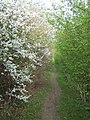
 Needham Lane in the spring - geograph.org.uk - 1246036.jpg 640 × 478 ; 91 kio
-
 Please Drive Carefull - geograph.org.uk - 1475862.jpg 640 × 480 ; 105 kio
-
 The Centre Of Wattisham - geograph.org.uk - 1480727.jpg 640 × 480 ; 79 kio
-
 Track to Clayhill Farm - geograph.org.uk - 4509627.jpg 1 024 × 768 ; 603 kio
-
 Track towards Hitcham - geograph.org.uk - 1429377.jpg 640 × 480 ; 91 kio
-
 Track towards Loose Hall - geograph.org.uk - 1429372.jpg 640 × 480 ; 75 kio
-
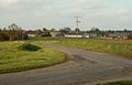
 Wattisham Airfield - geograph.org.uk - 1475976.jpg 640 × 480 ; 59 kio
-
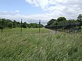 Wattisham Airfield perimeter fence - geograph.org.uk - 477877.jpg 640 × 480 ; 106 kio
-
 Wattisham Road near Ware Cottage - geograph.org.uk - 4509664.jpg 1 024 × 768 ; 487 kio
-
 Cottages opposite the end of Mill Road - geograph.org.uk - 1429567.jpg 640 × 501 ; 93 kio
-
 Country lane - geograph.org.uk - 1429541.jpg 640 × 445 ; 74 kio
-
 Farm buildings at White House Farm - geograph.org.uk - 279384.jpg 640 × 450 ; 80 kio
-
 Farm near Battisford - geograph.org.uk - 1429572.jpg 640 × 391 ; 55 kio
-
 Farm near Wattisham - geograph.org.uk - 1429290.jpg 640 × 416 ; 59 kio
-
 Farmhouse at Nine Elms Farm - geograph.org.uk - 279467.jpg 640 × 480 ; 105 kio
-
 Farmland near Bird Street - geograph.org.uk - 1429522.jpg 640 × 412 ; 108 kio
-
 Field and distant cottages - geograph.org.uk - 1429535.jpg 640 × 381 ; 75 kio
-
 Field east of Knox Farm - geograph.org.uk - 1429518.jpg 640 × 431 ; 121 kio
-
 Footpath by wheat field - geograph.org.uk - 1429353.jpg 640 × 376 ; 66 kio
-
 Harvested field - geograph.org.uk - 1429312.jpg 640 × 452 ; 89 kio
-
 Lodge Farm, as seen from The Drive - geograph.org.uk - 279452.jpg 640 × 412 ; 47 kio
-
 Public Footpath near Wattisham - geograph.org.uk - 279375.jpg 640 × 425 ; 97 kio
-
 Road to Nayland Farm - geograph.org.uk - 279470.jpg 640 × 453 ; 106 kio
-
 Tye Farm as viewed from Nedging Road - geograph.org.uk - 277185.jpg 640 × 400 ; 41 kio
-
 Ware Road, looking towards Wattisham, Suffolk - geograph.org.uk - 279377.jpg 640 × 480 ; 91 kio


