Category:Zhuoshui River
Aller à la navigation
Aller à la recherche
river in Taiwan  | |||||
| Téléverser des médias | |||||
| Nature de l’élément | |||||
|---|---|---|---|---|---|
| Lieu | |||||
| Longueur |
| ||||
| Source | |||||
| Se jette dans | |||||
| Bassin versant | |||||
| Affluent |
| ||||
| À ne pas confondre avec | |||||
 | |||||
Afrikaans: Hierdie kategorie bevat beelde en ander lêers wat verband hou met Zhuoshuirivier.
Deutsch: Diese Kategorie enthält Medien zur Zhuoshui.
Español: Esta categoría contiene imágenes y otros archivos relacionados con Río Zhuoshui.
English: Category for media items related to Zhuoshui River.
Français : Catégorie pour les fichiers multimédia relatif au Zhuoshui.
日本語: 濁水渓に関するカテゴリ。
Português: Imagens e multimédia relacionados com Rio Zhuoshui.
Русский: Эта категория содержит медиафайлы по теме Чжошуйси.
中文(臺灣):濁水溪有關的媒體集。
Sous-catégories
Cette catégorie comprend 8 sous-catégories, dont les 8 ci-dessous.
Média dans la catégorie « Zhuoshui River »
Cette catégorie comprend 63 fichiers, dont les 63 ci-dessous.
-
-

-

-

-

-
 Aqueduct over the Zhuoshui River.jpg 3 264 × 2 448 ; 2,83 Mio
-
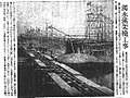 Bridge construction on Zhuoshui River on Taiwan Nichi Nichi Shimpō.jpg 532 × 398 ; 125 kio
-

-

-

-

-
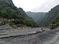
 Chuping Canyon in rainy weather on 9 October 2016.jpg 6 000 × 4 000 ; 14,02 Mio
-

-
 Dingkan Waterfall during drought which the Zhuoshui River flows in the morning on 27 March 2021.jpg 3 000 × 4 000 ; 4,01 Mio
-
 Distant view of THSR Zhuoshui River Bridge under cloudy sunny sky on 11 June 2021.jpg 4 000 × 3 000 ; 2,27 Mio
-
 Dusk view of Zhuoshui River from Xiangbishan Observation Deck.jpg 6 016 × 4 016 ; 11,67 Mio
-

-

-
 Mountain view between Wujie to Lishi Creek's narrow canyon, as taken on 11th October 2020.jpg 4 000 × 3 000 ; 5,18 Mio
-
 Name sign of the Jhuoshuei River on the way to the Zhangyun Bridge.jpg 4 000 × 3 000 ; 2,29 Mio
-
 Nantou Township Road 83 looking northwest towards Chuping Canyon on 9 October 2016.jpg 6 000 × 4 000 ; 14,64 Mio
-

-

-
 Overlooking the Zhuoshui River towards Wujie in the distance.jpg 6 000 × 4 000 ; 15,04 Mio
-
 Red traffic light seen at the north end of Mingzhu Bridge.jpg 4 000 × 3 000 ; 2,27 Mio
-
 Shuili Panoramic.jpg 3 392 × 1 044 ; 447 kio
-

-
 Steep cliff at Dingkan Waterfall which the Zhuoshui River flows in the morning on 27 March 2021.jpg 4 000 × 3 000 ; 4,98 Mio
-
 Sunhai Bridge ruins and the Danda Suspension Bridge east pylon, as taken on 16th October 2020.jpg 4 000 × 3 000 ; 5,97 Mio
-
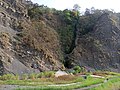
 Sunhai Bridge ruins in the Zhuoshui River valley on 16th October 2020.jpg 4 000 × 3 000 ; 4,01 Mio
-
 Sunhai Bridge ruins, northward view from temporary bridge, as taken on16th October 2020.jpg 4 000 × 3 000 ; 4,42 Mio
-
 Sunhai Bridge ruins, view northwest from Danda Forest Road, as taken on 16th October 2020.jpg 4 000 × 3 000 ; 3,37 Mio
-
 Sunset over Bagua Plateau as seen from Xiangbishan Observation Deck.jpg 6 016 × 4 016 ; 11,66 Mio
-
 View along the Zhuoshui River valley to Shuili.jpg 2 800 × 1 867 ; 876 kio
-

-
 View east along the Sunhai Bridge ruins in the afternoon on 16th October 2020.jpg 3 000 × 4 000 ; 5,47 Mio
-

-

-

-
 Wujie Overlook.jpg 4 496 × 3 000 ; 11,84 Mio
-
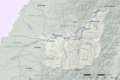 Zhuoshui basin map.png 1 747 × 1 165 ; 1,26 Mio
-
 Zhuoshui River at the Sunhai Bridge ruins, upstream view taken on 16th October 2020.jpg 4 000 × 3 000 ; 4,68 Mio
-
 Zhuoshui river bend, view from Wujie Forest Road, as taken on 11th October 2020.jpg 4 000 × 3 000 ; 3,38 Mio
-
 Zhuoshui River downstream, Xiluo Bridge looking west, as taken on 11 June 2021.jpg 4 000 × 3 000 ; 2,64 Mio
-

-

-

-
 Zhuoshui River flowing through the Sunhai Bridge ruins in the afternoon on 16th October 2020.jpg 4 000 × 3 000 ; 3,85 Mio
-

-
 Zhuoshui River valley, view from Wujie Forest Road, as taken on 11th October 2020.jpg 3 000 × 4 000 ; 4,04 Mio
-
 Zhuoshui River with Chenyoulan River in the distance under cloudy sunny sky on 29 August 2021.jpg 3 000 × 4 000 ; 2,34 Mio
-

-

-
 Zhuoshui River, Nantou County (Taiwan).jpg 4 928 × 3 264 ; 6,01 Mio
-
 Zhuoshuixishiyitu.PNG 950 × 460 ; 31 kio
-
 台灣省雲林縣西螺鎮警告交通告示 西螺堤防 濁水溪.jpg 1 936 × 2 592 ; 2,11 Mio
-
 濁水溪 - panoramio.jpg 1 536 × 1 152 ; 312 kio
-
 濁水溪 Zhuoshui River - panoramio (1).jpg 6 000 × 4 000 ; 5,13 Mio
-
 濁水溪 Zhuoshui River - panoramio.jpg 6 000 × 4 000 ; 7,31 Mio
-
 濁水溪.jpg 925 × 393 ; 81 kio
-
 過坑至武界途中跨越濁水溪的鐵線橋 1934年臺灣寫真大觀:山岳編.jpg 844 × 613 ; 1,15 Mio
-
 集集濁水溪.jpg 6 224 × 1 884 ; 7,62 Mio
-
 集集鎮獅頭山登天步道俯瞰濁水溪以及集集攔河堰2.jpg 4 032 × 3 024 ; 4,23 Mio


.jpg)


.jpg)


