Category:Česká Ves (Jablonné v Podještědí)
Jump to navigation
Jump to search
part of Jablonné v Podještědí in Liberec District  | |||||
| Upload media | |||||
| Instance of | |||||
|---|---|---|---|---|---|
| Location | Jablonné v Podještědí, Liberec District, Liberec Region, Czechia | ||||
| Population |
| ||||
| Area |
| ||||
 | |||||
Subcategories
This category has the following 2 subcategories, out of 2 total.
D
- Dub u Františkova (16 F)
Media in category "Česká Ves (Jablonné v Podještědí)"
The following 21 files are in this category, out of 21 total.
-
 Jablonné v Podještědí, Česká Ves, house No 427.jpg 3,093 × 2,258; 1.55 MB
-
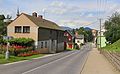
 Jablonné v Podještědí, Česká Ves, intersection.jpg 3,351 × 2,219; 1.55 MB
-
 Jablonné v Podještědí, Česká Ves, main street.jpg 3,404 × 2,106; 1.57 MB
-
 Jablonné v Podještědí, Česká Ves, restaurant.jpg 3,648 × 2,432; 1.81 MB
-
 Jablonné v Podještědí, Česká Ves, side street 2.jpg 2,991 × 2,111; 1.37 MB
-
 Jablonné v Podještědí, Česká Ves, side street.jpg 2,912 × 2,087; 1.6 MB
-
 Jablonné v Podještědí, Česká Ves, tenement houses.jpg 3,609 × 2,342; 1.92 MB
-
 Kaplička v zahradě domu 8 v České Vsi (Q94435512) 01.jpg 1,200 × 857; 113 KB
-
 Kaplička v zahradě domu 8 v České Vsi (Q94435512) 02.jpg 828 × 1,200; 109 KB
-
 Kříž poblíž domu 73 v České Vsi (Q94436850) 01.jpg 1,200 × 794; 252 KB
-
 Kříž poblíž domu 73 v České Vsi (Q94436850) 02.jpg 811 × 1,200; 222 KB
-
 Kříž poblíž domu 73 v České Vsi (Q94436850) 03.jpg 858 × 1,200; 169 KB
-
 Kříž poblíž domu 73 v České Vsi (Q94436850) 04.jpg 1,200 × 800; 360 KB
-
 Kříž u domu 6 v České Vsi (Q94437904) 01.jpg 1,200 × 871; 148 KB
-
 Kříž u domu 6 v České Vsi (Q94437904) 02.jpg 882 × 1,200; 56 KB
-
 Kříž u silnice 270 v České Vsi (Q94438357).jpg 1,200 × 796; 136 KB
-
 Pomník padlým v 1. světové válce v České Vsi (Q94443988) 01.jpg 1,200 × 820; 242 KB
-
 Pomník padlým v 1. světové válce v České Vsi (Q94443988) 02.jpg 908 × 1,200; 311 KB
-
 Česká Ves (u Jablonného v Podještědí) - čp. 55.jpg 2,592 × 1,944; 2.98 MB
-
 Česká Ves (u Jablonného v Podještědí) - čp. 58, 61 a 62.jpg 2,592 × 1,944; 3.51 MB
-
 Česká Ves (u Jablonného v Podještědí) - čp. 63 a 65.jpg 2,592 × 1,944; 3.6 MB


_01.jpg)
_02.jpg)
_01.jpg)
_02.jpg)
_03.jpg)
_04.jpg)
_01.jpg)
_02.jpg)
.jpg)
_01.jpg)
_02.jpg)
_-_%C4%8Dp._55.jpg)
_-_%C4%8Dp._58,_61_a_62.jpg)
_-_%C4%8Dp._63_a_65.jpg)