Category:12 Hanover Street, Liverpool
Jump to navigation
Jump to search
| Object location | | View all coordinates using: OpenStreetMap |
|---|
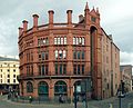
Warehouse Block Between Duke Street, Argyle Street And Duke Street Lane.  | |||||
| Upload media | |||||
| Instance of | |||||
|---|---|---|---|---|---|
| Location | Liverpool, Merseyside, North West England, England | ||||
| Heritage designation |
| ||||
 | |||||
Subcategories
This category has the following 2 subcategories, out of 2 total.
C
W
Media in category "12 Hanover Street, Liverpool"
The following 7 files are in this category, out of 7 total.
-
 12 Hanover Street 2018.jpg 4,100 × 3,218; 6.5 MB
-
 12 Hanover Street rear.jpg 3,220 × 4,739; 9.3 MB
-
 12 Hanover Street, Liverpool - geograph.org.uk - 2875106.jpg 640 × 485; 200 KB
-
 12 Hanover Street, Liverpool.jpg 4,413 × 3,576; 7.55 MB
-
 Entrance to 12 Hanover Street, Liverpool.jpg 4,905 × 3,306; 10.44 MB
-
 Paradise Street - geograph.org.uk - 2986611.jpg 1,200 × 800; 1.1 MB
-
 Plaque at 12 Hanover Street, Liverpool.jpg 2,832 × 2,832; 6.41 MB


