Category:16th-century maps of Augsburg
Jump to navigation
Jump to search
Subcategories
This category has only the following subcategory.
M
Media in category "16th-century maps of Augsburg"
The following 9 files are in this category, out of 9 total.
-
 Ausschnitt Seld Hoher Weg.jpg 2,448 × 1,836; 1.62 MB
-
 Ausschnitt Seld Tanzhaus.jpg 3,264 × 1,836; 2.11 MB
-
 Seld Joerg Vogelschauplan von Westen Augsburg.jpeg 1,500 × 631; 624 KB
-
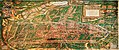
 Augsburg 1549.jpg 1,024 × 768; 388 KB
-
 Plan Augsburg 1550.jpg 7,929 × 6,193; 14.62 MB
-
 Augsburg Stadtansicht von Osten Rogel Hans.jpeg 2,048 × 1,539; 987 KB
-
 Wolf-Dietrich-Klebeband Städtebilder G 079 III.jpg 2,000 × 1,547; 1.59 MB
-
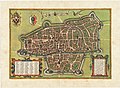
 Braun Augsburg UBHD.jpg 2,076 × 1,490; 2.23 MB
-
 Stadtplan Augsburg von 1572.jpg 13,300 × 9,804; 63.53 MB


