Category:16th-century maps of Hispaniola
Jump to navigation
Jump to search
Countries of North America: The Bahamas · Canada · Costa Rica · Cuba · Guatemala · Honduras · Jamaica · Mexico · Panama · United States of America‡
Other territories: Bermuda · Greenland · Guadeloupe · Martinique · Puerto Rico
‡: partly located in North America
Other territories: Bermuda · Greenland · Guadeloupe · Martinique · Puerto Rico
‡: partly located in North America
Subcategories
This category has only the following subcategory.
H
Media in category "16th-century maps of Hispaniola"
The following 22 files are in this category, out of 22 total.
-
 1502 Cantino Antillas.png 1,405 × 899; 2.9 MB
-
 1514 Cornelius Aurelius Spangnola frente a Lisbona.jpg 872 × 785; 143 KB
-
 1528 - Bordone - BNF - Spagnola.jpg 1,140 × 671; 126 KB
-
 1534 - Isolario di Benedetto Bordone - Nuevo Mundo.jpg 796 × 463; 97 KB
-
 1534 - Isolario di Benedetto Bordone - Spagnola.jpg 833 × 513; 95 KB
-
 1535 Admiralty's map by Lorenz Fries.jpg 12,045 × 8,224; 18.32 MB
-

-
 1565 Hispaniola Ramusio Delle Navigationi vol3 p44.png 888 × 547; 1.37 MB
-
 Il Desegno del Discoperto della Nova Franza.jpg 2,131 × 1,500; 888 KB
-
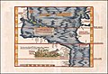
 DeBry Map of Caribbean & Florida1594.jpg 1,619 × 1,092; 1.68 MB
-

-
 Atlas Ortelius KB PPN369376781-004av-004br.jpg 3,000 × 2,194; 4.5 MB
-

-
 Descriptionis Ptolemaicæ avgmentvm siue Occidentis notitia breui commentario illustrata p182.tif 6,234 × 4,799; 85.62 MB
-
-
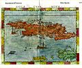 Girolamo Ruscelli. Cuba, Jamaica and Hispaniola. 1562.jpg 2,037 × 1,700; 660 KB
-
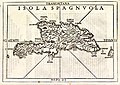 Isola Spagnuola.jpg 1,800 × 1,281; 850 KB
-

-
 Mapa de las Antillas 1.JPG 3,607 × 2,355; 6.3 MB
-
 Mapa del Caribe y América Central (Siglo XVI).jpg 848 × 1,115; 998 KB
-
 Waldseemuller map Caribbean.jpg 2,057 × 3,045; 3.89 MB
-


_66.jpg)

.jpg)


.jpg)

_Hispaniolae,_Cubae,_aliarumque_insularum_circumiacientium,_delineatio_1579_(1581)_UTA.jpg)