Category:1700s maps of France
Jump to navigation
Jump to search
Countries of Europe: Albania · Armenia‡ · Austria · Azerbaijan‡ · Belgium · Croatia · Denmark · France‡ · Georgia‡ · Germany · Greece · Hungary · Republic of Ireland · Italy · Lithuania · Netherlands‡ · Norway · Portugal‡ · Romania · Russia‡ · Serbia · Slovenia · Spain‡ · Sweden · Switzerland · Turkey‡ · Ukraine
‡: partly located in Europe
‡: partly located in Europe
Subcategories
This category has the following 10 subcategories, out of 10 total.
- 1703 maps of France (5 F)
- 1708 maps of France (5 F)
Media in category "1700s maps of France"
The following 29 files are in this category, out of 29 total.
-

-

-
 Map of the sea coast at Nantes.jpg 1,000 × 790; 800 KB
-

-
 Histoire-de-Guillaume-III-MG 0123.tif 4,374 × 3,586; 44.91 MB
-

-
 Anciennes et nouvelles sondes à Portlouis - Lebloch ; Lesage - btv1b53153586z (1 of 2).jpg 9,666 × 6,474; 6.22 MB
-
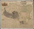 Plan de la Ville & Cité d'Arras - 1704.png 10,649 × 9,249; 139.93 MB
-

-
 A chart of the bay of BISCAY from the Isle Ouessant to Cape Finisterre NYPL1640595.tiff 7,230 × 5,428; 112.28 MB
-

-

-
 Eslection de Chasteau Chinon.jpg 1,134 × 1,012; 325 KB
-
 Evesché de Luçon (5121156382).jpg 2,000 × 1,448; 2.77 MB
-
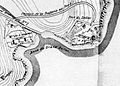 Fort du Dellec map.jpg 683 × 490; 210 KB
-
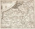
 Johann Christofle Steinsberger - Royaume de France et conquêtes de Louis le Grand - 001.jpg 7,800 × 6,509; 11.38 MB
-
 Karte1.jpg 4,388 × 3,196; 5.1 MB
-

-
 Le Diocese de Toulouse (5121161808).jpg 2,000 × 1,427; 3.13 MB
-
 LEvesché de Blois, divisé en Archidiaconéz et Doyennéz (4587189862).jpg 2,000 × 1,427; 2.93 MB
-
 1702-Aurelianensis praefectura generalis.JPG 357 × 300; 34 KB
-
 Plan du Conquet et des environs vers 1700.jpg 612 × 431; 206 KB
-
 Post und Reisecarte der Wege durch Frankreich 1703.PNG 1,235 × 863; 2.09 MB
-
 The coast of BRETAGNE from I - Gueltas to Plougoulin NYPL1640590.tiff 7,230 × 5,428; 112.28 MB
-
 The coast of BRETAGNE from Port Douelan to Point Penvis NYPL1640597.tiff 7,230 × 5,428; 112.28 MB
-
 The coast of BRETAGNE from the Penmarks to Port Douelan NYPL1640596.tiff 7,230 × 5,428; 112.28 MB
-
 The coast of BRETAGNE including the bay of BREST and DOVARNENEZ NYPL1640592.tiff 7,230 × 5,428; 112.28 MB
-

-
 Îles d'Hyères old map.jpg 778 × 423; 221 KB
heni_superioris_(inferioris),_Mosae_et_Mosellae_tabula_-_ac_minores_in_eosdem_in_fluentes_Fluvii,_cum_omnibus_adherentibus_regionibus_sicut_Archiepiscopatus_et_Electoratus,_Moguntini_et_Palatinatus..._-_btv1b10223304s.jpg)
.jpg)

t_Gen(er)al_du_Languedoc_divis%C3%A9_en_ses_vingt_deux_dioc%C3%A8ses_-_Par_le_Sr._Sanson_d%27Abbeville._-_btv1b531794957_(1_of_2).jpg)

.jpg)


.jpg)


.jpg)
.jpg)
.jpg)


