Category:1706 maps of Europe
Jump to navigation
Jump to search
English: 1706 maps of Europe
Español: Mapas de Europa en 1706
Suomi: Euroopan kartat vuodelta 1706
Română: Hărți ale Europei din 1706
Subcategories
This category has the following 6 subcategories, out of 6 total.
Media in category "1706 maps of Europe"
The following 6 files are in this category, out of 6 total.
-
-
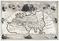
 1706 De La Feuille Map of Europe - Geographicus - Europe-lafeuille-1706.jpg 2,452 × 1,809; 889 KB
-
 Ca. 1706 map of Europe during the Solar eclipse of May 12, 1706.jpg 14,154 × 12,392; 42.8 MB
-
 Eclipseos Solis totalis cum mora d. 12 Maji 1706 horis antem... - CBT 5871241.jpg 5,634 × 4,738; 10.57 MB
-
 Frederik de Wit, Nova et Accurata totius Europæ descriptio (FL33132725 2524193).jpg 14,948 × 12,538; 262.89 MB
-
 Novissima et accuratissima regnorum Hispaniae et Portugalliae tabula - CBT 5880267.jpg 5,600 × 4,669; 9.7 MB


.jpg)
