Category:1764 maps of Brest
Jump to navigation
Jump to search
Subcategories
This category has only the following subcategory.
Media in category "1764 maps of Brest"
The following 7 files are in this category, out of 7 total.
-
 5Fi01125 Plan du port et de la ville de Brest 1764.jpg 3,782 × 2,579; 1.26 MB
-
 5Fi01125 Plan du port et de la ville de Brest en 1764.jpg 2,836 × 1,954; 5.34 MB
-
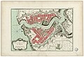
 Bellin - Plan Brest 1764.jpg 2,569 × 1,789; 2.13 MB
-
 Brest 1764 Hopital maritime.jpg 323 × 426; 31 KB
-

-
 Jacques-Nicolas Bellin Carte de la rade de Brest.jpg 1,399 × 944; 952 KB
-
 Plan du port et ville de Brest - Bellin - btv1b85919340.jpg 6,023 × 4,511; 5.32 MB


