Category:1764 maps of the United States
Jump to navigation
Jump to search
Countries of North America: The Bahamas · Canada · United States of America‡
‡: partly located in North America
‡: partly located in North America
| ← 1760 1761 1762 1763 1764 1765 1766 1767 1768 1769 → |
Subcategories
This category has the following 4 subcategories, out of 4 total.
F
- 1764 maps of Florida (12 F)
L
- 1764 maps of Louisiana (1 F)
M
- 1764 maps of Massachusetts (6 F)
O
- 1764 maps of Ohio (1 F)
Media in category "1764 maps of the United States"
The following 9 files are in this category, out of 9 total.
-
 1764 map of Charleston, South Carolina.jpeg 861 × 1,208; 255 KB
-
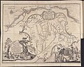
 Carte de la nouvelle Georgia. LOC 74692212.jpg 2,462 × 3,121; 1.11 MB
-
 ChickasawWars.jpg 490 × 809; 155 KB
-
 Embouchures du Fleuve St. Louis ou Mississipi.jpg 1,500 × 1,863; 1.55 MB
-
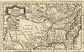 Map of Louisiana 1.jpg 2,100 × 1,304; 626 KB
-
 Plan de la Nouvelle Orleans. LOC 2003627002.jpg 3,547 × 2,616; 1.36 MB
-

-
-
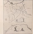
 Thomas Hutchins Map of Henry Bouquet's 1764 Expedition.jpg 9,706 × 7,739; 20.11 MB


.jpg)

.jpg)