Category:1770 maps of New Jersey
Jump to navigation
Jump to search
Media in category "1770 maps of New Jersey"
The following 4 files are in this category, out of 4 total.
-
 (Map of the coast of New Jersey from Barnegat Inlet to Cape May. LOC 73691635.jpg 4,176 × 2,680; 1.19 MB
-
 (Map of the coast of New Jersey from Barnegat Inlet to Cape May. LOC 73691635.tif 4,176 × 2,680; 32.02 MB
-
 A draught of Delaware Bay. LOC gm72003568.jpg 13,657 × 6,637; 9.71 MB
-
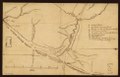
 Part of New Jersey. LOC gm72003571.tif 9,038 × 16,584; 428.83 MB

