Category:1780s maps of Romania
Jump to navigation
Jump to search
Countries of Europe: Albania · Armenia‡ · Austria · Azerbaijan‡ · Belgium · Bosnia and Herzegovina · Bulgaria · Croatia · Cyprus‡ · Czech Republic · Finland · France‡ · Georgia‡ · Germany · Greece · Hungary · Republic of Ireland · Italy · Lithuania · Moldova · Netherlands‡ · Norway · Poland · Portugal‡ · Romania · Russia‡ · Serbia · Slovenia · Spain‡ · Sweden · Switzerland · Turkey‡ · Ukraine · United Kingdom
Limited recognition: Abkhazia‡
‡: partly located in Europe
Limited recognition: Abkhazia‡
‡: partly located in Europe
Media in category "1780s maps of Romania"
The following 4 files are in this category, out of 4 total.
-
 William Faden. Composite Mediterranean. 1785.Q.jpg 2,143 × 703; 511 KB
-
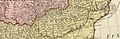
 Siebenbürgen BV004335942 1.jpg 9,417 × 12,696; 14.18 MB
-
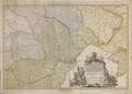
 Siebenbürgen BV004335942 2.jpg 9,450 × 12,654; 14.22 MB
-
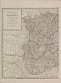
 Map Schütz Carl 1789.png 711 × 503; 731 KB


