Category:1781 maps of Canada
Jump to navigation
Jump to search
| ← 1780 1781 1783 1784 1785 1786 1787 1788 → |
English: Maps of Canada from 1781 or related to Canada in 1781
Français : Les cartes du Canada de 1781 ou se rapportant au Canada en 1781
Media in category "1781 maps of Canada"
The following 17 files are in this category, out of 17 total.
-
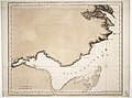
 Annapolis Royal (and) St. Mary's Bay RMG K0459.jpg 994 × 1,280; 1.03 MB
-
 Chaleur Bay RMG K0336.jpg 1,280 × 952; 904 KB
-
 Chaleur Bay RMG K0337.jpg 1,280 × 954; 977 KB
-
 Chignecto Bay RMG K0449.jpg 1,030 × 1,280; 1.03 MB
-
 Chignecto Bay RMG K0450.jpg 985 × 1,280; 1.13 MB
-
 Chignecto Bay RMG K0451.jpg 998 × 1,280; 1.15 MB
-
 Chignecto Bay RMG K0452.jpg 1,280 × 636; 853 KB
-
 Grand Manan Island and the coast of northern Maine (3045762099).jpg 2,000 × 1,411; 2.16 MB
-
 Halifax Harbour - Catch Harbour - (10294916994).jpg 800 × 451; 84 KB
-
 Miramichi Bay RMG K0341.jpg 1,280 × 933; 895 KB
-
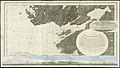
 North east coast of Nova Scotia and Northumberland Strait RMG K0645.jpg 1,280 × 640; 668 KB
-
 North east coast of Nova Scotia and Northumberland Strait RMG K0646.jpg 1,280 × 658; 637 KB
-
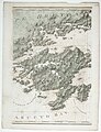 Richmond Isles and Chedabucto Bay RMG K0629.jpg 980 × 1,280; 1.18 MB
-
 Richmond Isles and Chedabucto Bay RMG K0630.jpg 980 × 1,280; 875 KB
-
 Richmond Isles and Chedabucto Bay RMG K0631.jpg 1,280 × 654; 746 KB
-
 Richmond Isles and Chedabucto Bay RMG K0632.jpg 1,280 × 649; 766 KB
-
 The coast of northern Maine and New Brunswick (3045761991).jpg 2,000 × 1,409; 2.34 MB
_St._Mary%27s_Bay_RMG_K0459.jpg)


.jpg)
.jpg)


.jpg)