Category:1790s maps of Bavaria
Jump to navigation
Jump to search
|
Federal states of Germany: |
Subcategories
This category has the following 2 subcategories, out of 2 total.
- 1791 maps of Bavaria (3 F)
Media in category "1790s maps of Bavaria"
The following 2 files are in this category, out of 2 total.
-
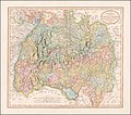 1799 map of Swabia by John Cary.jpg 13,999 × 12,380; 33.21 MB
-
 1799 Cary Map of Franconia, Germany ( Nuremburg ) - Geographicus - Franconia-cary-1799.jpg 5,000 × 4,443; 7.44 MB

_-_Geographicus_-_Franconia-cary-1799.jpg)