Category:1790s maps of Delaware
Jump to navigation
Jump to search
States of the United States: Alaska · Connecticut · Delaware · Florida · Georgia · Indiana · Kentucky · Louisiana · Maryland · Massachusetts · Missouri · New Hampshire · New Jersey · New York · North Carolina · Ohio · Pennsylvania · South Carolina · Tennessee · Vermont – Washington, D.C.
Puerto Rico
Puerto Rico
Media in category "1790s maps of Delaware"
The following 12 files are in this category, out of 12 total.
-
 1792 Delaware gubernatorial election results map by county.png 800 × 1,556; 48 KB
-

-
-

-
 Delaware from the best authorities LOC 2018590122.jpg 2,769 × 4,853; 2.06 MB
-
 Delaware from the best authorities LOC 2018590122.tif 2,769 × 4,853; 38.45 MB
-
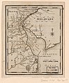 Delaware. LOC 2018590120.jpg 2,174 × 2,626; 787 KB
-
 Delaware. LOC 2018590120.tif 2,174 × 2,626; 16.33 MB
-
 Map of the early settlements of Delaware County, Penna.jpg 5,495 × 4,397; 7.79 MB
-

-
 Maryland 1796.jpg 5,431 × 4,591; 3.35 MB
-
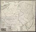
 The states of Maryland and Delaware from the latest surveys, 1799. LOC 76695374.tif 2,872 × 2,436; 20.02 MB

.jpg)
.jpg)


.jpg)
