Category:17th-century maps of Pennsylvania
Jump to navigation
Jump to search
States of the United States: Alaska · California · Connecticut · Delaware · Florida · Georgia · Illinois · Louisiana · Maine · Maryland · Massachusetts · New Hampshire · New Jersey · New Mexico · New York · North Carolina · Oregon · Pennsylvania · Rhode Island · South Carolina · Texas · Virginia
Puerto Rico
Puerto Rico
Subcategories
This category has the following 8 subcategories, out of 8 total.
- 1630s maps of Pennsylvania (2 F)
- 1670s maps of Pennsylvania (1 F)
- 1690s maps of Pennsylvania (2 F)
P
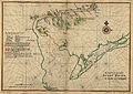
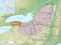
Media in category "17th-century maps of Pennsylvania"
The following 11 files are in this category, out of 11 total.
-

-
 CAMPANIUS1834 NewSweden Pg089.jpg 1,063 × 1,631; 1.01 MB
-
 5NationsExpansion.jpg 441 × 443; 45 KB
-

-
 Bub gb IGk3AQAAMAAJ 0055.jpg 2,500 × 3,744; 979 KB
-
 Delaware Bay Vinckeboons.jpg 8,423 × 5,971; 28 MB
-

-

-

-

-
 Wenro Territory ca1630 map-en.svg 2,300 × 1,700; 9.76 MB
.jpg)


_(14596720309).jpg)


.jpg)
.jpg)

.jpg)