Category:17th-century maps of the Spanish Empire
Jump to navigation
Jump to search
Subcategories
This category has the following 18 subcategories, out of 18 total.
.
A
B
- 17th-century maps of Bolivia (8 F)
C
- 17th-century maps of Colombia (12 F)
E
H
M
P
- 17th-century maps of Peru (24 F)
U
- 17th-century maps of Uruguay (17 F)
V
- 17th-century maps of Venezuela (43 F)
Media in category "17th-century maps of the Spanish Empire"
The following 40 files are in this category, out of 40 total.
-
 Europe in search of new routes to India and China, 1486-1616 A.D..jpg 4,667 × 2,708; 7.78 MB
-

-
 "Artesia Comitatus = Artois" (22267367091).jpg 3,837 × 3,019; 2.93 MB
-
 "Brabantia Ducatus" (22069287410).jpg 3,821 × 2,919; 2.78 MB
-

-

-
 America-10.17.49-AM.jpg 1,199 × 933; 580 KB
-

-
 Map of the north of the island of Formosa 1626-1642.jpg 720 × 990; 118 KB
-
 Map of the Spanish Port in Jilong, Taiwan, 1626.jpg 1,000 × 1,391; 554 KB
-
 Partie de Terre Ferme ou sont Guiane et Caribane (4586556023).jpg 2,000 × 1,469; 2.75 MB
-

-
 Regno Di Napoli - Atlas Maior, vol 9, map 47 - Joan Blaeu, 1667 - BL 114.h(star).9.(47).jpg 4,000 × 2,818; 1.46 MB
-
 Sicilia Regnvm - Atlas Maior, vol 9, map 60 - Joan Blaeu, 1667 - BL 114.h(star).9.(60).jpg 4,000 × 2,818; 1.44 MB
-

-

-

-
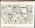
 Perv - Atlas Maior, vol 12, map 12 - Joan Blaeu, 1667 - BL 114.h(star).12.(12).jpg 4,000 × 2,818; 1.39 MB
-
 Chili - Atlas Maior, vol 12, map 13 - Joan Blaeu, 1667 - BL 114.h(star).12.(13).jpg 4,000 × 2,818; 1.36 MB
-

-

-
 Venezvela… - Atlas Maior, vol 12, map 23 - Joan Blaeu, 1667 - BL 114.h(star).12.(23).jpg 4,000 × 2,818; 1.51 MB
-
 Corso del fiume dell Amazon (8642164049).jpg 799 × 636; 145 KB
-
 1698 Louis Hennepin Map of North America - Geographicus - NorthAmerica-hennepin-1698.jpg 4,500 × 3,751; 4.79 MB
-

-

-

-
 Cambrésis 1659 Joan Blaeu.jpg 1,088 × 862; 254 KB
-

-
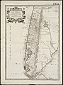 Le Chili.jpg 1,481 × 2,000; 2.64 MB
-
 Le Nouveau Mexique et la Floride (4072646568).jpg 2,000 × 1,294; 2.65 MB
-
 Map of Patagonia, Argentina.jpg 600 × 800; 119 KB
-
 Map of Peru.jpg 600 × 800; 109 KB
-
 Map of Puerto Rico, 1685.jpg 596 × 900; 465 KB
-
 Map of South America, 1685.jpg 621 × 900; 456 KB
-
 Mapa de Venezuela 1635.jpg 800 × 617; 252 KB
-
 NicolasCardona1632.jpg 1,080 × 672; 1.17 MB
-
 Part of the San Juan Bay (Plan of San Juan Luis Venegas Osorio, 1678).jpg 1,486 × 998; 941 KB
-

-
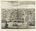 Urbs Domingo in Hispaniola - Montanus - 1671.jpg 1,690 × 1,494; 2.03 MB

_European_explorations_and_colonies_from_the_fifteenth_to_the_seventeeth_century.jpg)
.jpg)
.jpg)
.jpg)
_irrigatur.%22_(22230454045).jpg)


.jpg)
.4.(19).jpg)
.9.(47).jpg)
.9.(60).jpg)
.12.(6).jpg)
.12.(7).jpg)
.12.(11).jpg)
.12.(12).jpg)
.12.(13).jpg)
.12.(14).jpg)
.12.(15).jpg)
.12.(23).jpg)
.jpg)

.jpg)
.jpg)
.jpg)

,_RP-P-AO-18-163.jpg)

.jpg)


.jpg)
.jpg)
