Category:1800s maps of North Rhine-Westphalia
Jump to navigation
Jump to search
Federal states of Germany:
Subcategories
This category has only the following subcategory.
Media in category "1800s maps of North Rhine-Westphalia"
The following 5 files are in this category, out of 5 total.
-
 TrK44-Neuss-Detail.jpg 2,273 × 2,322; 6.11 MB
-
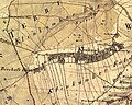 Klinkum.jpg 906 × 726; 464 KB
-
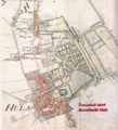 Hüls Tranchot 1807.png 649 × 715; 1.27 MB
-
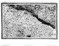 Karte nrw le coq.jpg 11,566 × 9,027; 45.05 MB
-


