Category:1800s maps of South America
Jump to navigation
Jump to search
Temperate regions: North America · South America · Africa · Europe · Asia · Oceania – Polar regions: – Other regions:
Subcategories
This category has the following 14 subcategories, out of 14 total.
- 1800 maps of South America (5 F)
- 1804 maps of South America (5 F)
- 1806 maps of South America (5 F)
- 1807 maps of South America (4 F)
- 1808 maps of South America (4 F)
- 1809 maps of South America (empty)
A
- 1800s maps of Argentina (5 F)
B
- 1800s maps of Brazil (4 F)
C
- 1800s maps of Chile (1 F)
- 1800s maps of Colombia (5 F)
E
- 1800s maps of Ecuador (2 F)
P
- 1800s maps of Paraguay (1 F)
U
- 1800s maps of Uruguay (3 F)
V
Media in category "1800s maps of South America"
The following 8 files are in this category, out of 8 total.
-
 Alexander Humboldt y Aime Bonpland.jpg 1,800 × 2,728; 5.21 MB
-
 Amérique méridionale - par J. B. Poirson... - btv1b8468798b.jpg 6,448 × 7,792; 6.88 MB
-
 Nouvel atlas portatif 1806 (138991387).jpg 5,955 × 5,153; 24.52 MB
-
 Amérique méridionale - par P. Lapie - btv1b8469849h.jpg 4,159 × 5,289; 3.58 MB
-
 John Russell, South America (FL13728529 2511715).jpg 3,920 × 4,595; 27.08 MB
-

-
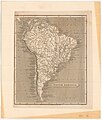
 America del Sud.jpg 3,162 × 4,337; 10.88 MB
-


.jpg)

.jpg)
%27_(10998431375).jpg)

