Category:1804 maps of North America
Jump to navigation
Jump to search
Temperate regions: North America · South America · Africa · Europe · Asia · – Polar regions: – Other regions:
| ← 1800 1801 1802 1803 1804 1805 1806 1807 1808 1809 → |
Subcategories
This category has only the following subcategory.
U
Media in category "1804 maps of North America"
The following 13 files are in this category, out of 13 total.
-

-
 A map of New Spain, from 16⁰ to 38⁰ North latitude reduced from the large map LOC 2006626018.tif 3,508 × 5,055; 50.73 MB
-
 Charte von Nordamerica.jpg 7,064 × 8,348; 16.25 MB
-

-

-
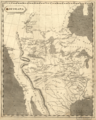
 Louisiana (2674479905).jpg 1,574 × 2,000; 2.88 MB
-
 Louisiana1804 loc filename ct000654.png 2,460 × 3,081; 4.33 MB
-
 Louisiana1804a.jpg 2,460 × 3,081; 5.72 MB
-

-

-

-
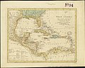 The West Indies and coast adjacent, reduced from the sheet map (4586553801).jpg 2,000 × 1,592; 2.93 MB
-
 Atlas moderne portatif 1804 (84189000).jpg 6,206 × 5,253; 4.52 MB


.jpg)


.jpg)
.jpg)
.jpg)