Category:1810s maps of Central America
Jump to navigation
Jump to search
Media in category "1810s maps of Central America"
The following 10 files are in this category, out of 10 total.
-
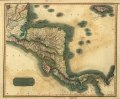
 1810 Tardieu Map of Mexico, Texas and California - Geographicus - Mexique-tardieu-1810.jpg 3,000 × 2,235; 1.84 MB
-
 Territories of the Governorate of Veragua.jpg 720 × 960; 137 KB
-
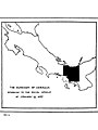 The Dukedom of Veragua.jpg 720 × 960; 117 KB
-
 West Indies map Brightly & Kinnersley 1812.png 1,919 × 1,079; 2.18 MB
-
 1814 Thomson Map of the West Indies ^ Central America - Geographicus - WestIndies-t-1814.jpg 5,000 × 4,215; 4.41 MB
-

-
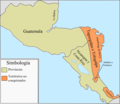 Capitanía General de Guatemala 1812.png 1,290 × 1,123; 184 KB
-
 Spanish North America, southern part (5121162956).jpg 2,000 × 1,558; 2.94 MB
-
 Spanish North America, southern part LOC 2004629007.jpg 7,699 × 6,346; 7.03 MB
-
 Spanish North America, southern part LOC 2004629007.tif 7,699 × 6,346; 139.78 MB


_Universal_Gazetteer_..._Revised,_considerably_enlarged,_and_improved,_by_Arthur_Kershaw._The_fourth_edition.)%27_(11003274663).jpg)

.jpg)
