Category:1810s maps of Slovenia
Jump to navigation
Jump to search
Countries of Europe: Albania · Armenia‡ · Austria · Azerbaijan‡ · Belgium · Bosnia and Herzegovina · Bulgaria · Croatia · Cyprus‡ · Czech Republic · Denmark · Finland · France‡ · Georgia‡ · Germany · Greece · Hungary · Republic of Ireland · Italy · Lithuania · Netherlands‡ · Norway · Poland · Portugal‡ · Romania · Russia‡ · Slovakia · Slovenia · Spain‡ · Sweden · Turkey‡ · Ukraine · United Kingdom
Limited recognition: Abkhazia‡
‡: partly located in Europe
Limited recognition: Abkhazia‡
‡: partly located in Europe
Media in category "1810s maps of Slovenia"
The following 12 files are in this category, out of 12 total.
-
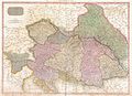 1818 Pinkerton Map of the Austrian Empire - Geographicus - Austria-pinkerton-1818.jpg 5,000 × 3,642; 5.51 MB
-
 Riedl - Koenigreiche Illyrien.jpg 7,150 × 5,808; 39.43 MB
-
 General Charte der Illyrischen Provinz 1810.jpg 8,694 × 7,388; 12.87 MB
-
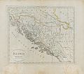 Illyria 1815.jpg 2,223 × 1,972; 574 KB
-
 Karte von Steyermark und Karnten 1813.jpg 5,232 × 4,088; 17.62 MB
-
-
 Königreich Illyrien und Herzogthum Steyermark 1819.jpg 25,281 × 27,029; 96.29 MB
-
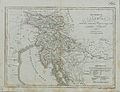
 Provinces Illyriennes Servie et Bosnie 1812.jpg 8,297 × 6,080; 5.91 MB
-
 Theil von Krain partia de la Carniole 1814.jpg 2,604 × 2,012; 754 KB
-
 Thiel von Krain partie de la Carniole 1814.jpg 3,348 × 2,933; 1.6 MB
-
 Upravni zemljevid Ilirskega kraljestva leta 1817.jpg 7,365 × 9,760; 9.56 MB
-
 Upravni zemljevid Ilirskih provinc leta 1813.jpg 5,742 × 4,752; 22.05 MB


