Category:1812 maps of Europe
Jump to navigation
Jump to search
Temperate regions: North America · South America · Africa · Europe · Asia · – Polar regions: – Other regions:
English: 1812 maps of Europe
Español: Mapas de Europa en 1812
Suomi: Euroopan kartat vuodelta 1812
Română: Hărți ale Europei din 1812
Subcategories
This category has the following 11 subcategories, out of 11 total.
.
C
F
G
I
N
- 1812 maps of Norway (3 F)
R
S
- 1812 maps of Spain (5 F)
T
- 1812 maps of Turkey (2 F)
U
- 1812 maps of the United Kingdom (11 F)
Media in category "1812 maps of Europe"
The following 11 files are in this category, out of 11 total.
-
 Carte de l'Empire Français 1812.jpg 9,338 × 6,938; 22.19 MB
-
 Empire Français et Royaume d'Italie 1812.jpg 6,000 × 4,558; 9.05 MB
-
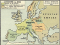 Europe in 1812.PNG 536 × 399; 458 KB
-
 France 1789-1813.jpg 9,110 × 6,818; 14.74 MB
-
 Improved dissected maps, combining instruction with amusement, Europe LOC 85695466.jpg 6,394 × 8,118; 7.37 MB
-
 Improved dissected maps, combining instruction with amusement, Europe LOC 85695466.tif 6,394 × 8,118; 148.51 MB
-
 Partie Occidentale de l'Empire Français 1812.jpg 4,544 × 6,082; 8.14 MB
-
 Partie Orientale de l'Empire Français 1812.jpg 5,975 × 4,485; 8.97 MB
-
 Partie Septentrionale de l'Empire Français 1812.jpg 5,947 × 4,526; 8.38 MB
-
 Territory of the Serbian Uprising (1812).svg 450 × 456; 585 KB
-
 The French revolution and first empire - an historical sketch (1901) (14779056071).jpg 3,752 × 2,690; 952 KB


.svg)
_(14779056071).jpg)