Category:1820 maps of the United States
Jump to navigation
Jump to search
Subcategories
This category has the following 6 subcategories, out of 6 total.
Media in category "1820 maps of the United States"
The following 66 files are in this category, out of 66 total.
-
 1820 Map of Manhattan.jpg 2,261 × 1,626; 498 KB
-

-

-

-
-

-

-

-
 Cadastral map of the blocks surrounding Washington Circle, Washington D.C.. LOC 88693202.jpg 6,543 × 9,544; 5.06 MB
-
 Cadastral map of the blocks surrounding Washington Circle, Washington D.C.. LOC 88693202.tif 6,543 × 9,544; 178.66 MB
-

-
 District of Columbia LOC 91686243.jpg 1,456 × 2,560; 480 KB
-
 District of Columbia LOC 91686243.tif 1,456 × 2,560; 10.66 MB
-
 Doaks-Stand.png 2,272 × 1,715; 40 KB
-
 Eastern & middle states LOC 2018590032.jpg 6,901 × 5,348; 3.26 MB
-
 Eastern & middle states LOC 2018590032.tif 6,901 × 5,348; 105.59 MB
-
 Fort Armstrong and Strother.jpg 733 × 593; 71 KB
-
 Kaart der vereenigde staten van Amerika, naar Mellishes - Dl. Veelwaard sculp. NYPL434601.tiff 3,167 × 2,408; 21.82 MB
-
 Lancaster District, South Carolina LOC 2007627632.jpg 5,115 × 6,516; 4.77 MB
-
 Lancaster District, South Carolina LOC 2007627632.tif 5,115 × 6,516; 95.36 MB
-
 Laurens District, South Carolina LOC 2007627645.jpg 7,278 × 5,677; 4.94 MB
-
 Laurens District, South Carolina LOC 2007627645.tif 7,278 × 5,677; 118.21 MB
-
 Manuscript map of the United States. LOC 2018590110.jpg 5,540 × 3,774; 2.22 MB
-
 Manuscript map of the United States. LOC 2018590110.tif 5,540 × 3,774; 59.82 MB
-
-

-
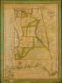
 Map of Alabama LOC 2012590211.jpg 6,597 × 8,921; 7.4 MB
-
 Map of Alabama LOC 2012590211.tif 6,597 × 8,921; 168.38 MB
-
 Map of Louisiana LOC 2013593202.jpg 8,640 × 6,625; 10.79 MB
-
 Map of Louisiana LOC 2013593202.tif 8,640 × 6,625; 163.77 MB
-

-

-

-
 Map of the state of Maine (4579372606).jpg 5,588 × 8,700; 15.25 MB
-
 Map of the state of Maine LOC 99462700.jpg 8,376 × 12,429; 16.18 MB
-
 Map of the state of Maine LOC 99462700.tif 8,376 × 12,429; 297.85 MB
-

-
 Map of the State of Ohio LOC 2011585875.jpg 5,312 × 6,016; 4.77 MB
-
 Map of the State of Ohio LOC 2011585875.tif 5,312 × 6,016; 91.43 MB
-

-

-
 Map of the United States of America - with the contiguous British and Spanish possessions LOC 96686682.tif 17,700 × 13,685; 693.01 MB
-

-
 Map of the United States of America - with the contiguous British and Spanish possessions LOC 96686683.tif 17,284 × 13,383; 661.79 MB
-

-
 Map of the United States of America - with the contiguous British and Spanish possessions LOC 96686684.tif 17,320 × 13,197; 653.95 MB
-
 New school history of the United States (1883) (14590776980).jpg 3,968 × 2,680; 2.14 MB
-
 Newberry District, South Carolina LOC 2007627689.jpg 5,105 × 4,722; 2.85 MB
-
 Newberry District, South Carolina LOC 2007627689.tif 5,105 × 4,722; 68.97 MB
-
 Newberry District, South Carolina LOC 2013593132.jpg 6,150 × 5,574; 4.72 MB
-
 Newberry District, South Carolina LOC 2013593132.tif 6,150 × 5,574; 98.08 MB
-
 Orangeburgh District, South Carolina LOC 2007627696.jpg 4,865 × 6,800; 5.09 MB
-
 Orangeburgh District, South Carolina LOC 2007627696.tif 4,865 × 6,800; 94.65 MB
-
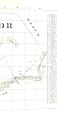
 Pendleton District, South Carolina LOC 2007627797.jpg 8,109 × 9,444; 11.94 MB
-
 Pendleton District, South Carolina LOC 2007627797.tif 8,109 × 9,444; 219.1 MB
-
 Plan of the Center Market and surrounding squares, Washington D.C.. LOC 88690781.jpg 6,695 × 5,400; 3.23 MB
-
 Plan of the Center Market and surrounding squares, Washington D.C.. LOC 88690781.tif 6,695 × 5,400; 103.43 MB
-

-

-
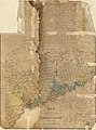
 Richland District, South Carolina LOC 2007627903.jpg 5,390 × 5,917; 4.92 MB
-
 Richland District, South Carolina LOC 2007627903.tif 5,390 × 5,917; 91.25 MB
-
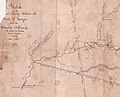
 Sketch of the 11th district of western Tennessee (14009762105).jpg 1,703 × 2,000; 3.07 MB
-
 Spartanburgh District, South Carolina LOC 2007627909.jpg 6,684 × 7,258; 5.96 MB
-
 Spartanburgh District, South Carolina LOC 2007627909.tif 6,684 × 7,258; 138.8 MB
-
 United States 1819-12-1820.png 1,000 × 677; 109 KB
-
 USurban1820.png 506 × 313; 6 KB

_(With_portraits.)%27_(11004945345).jpg)
_(With_portraits.)%27_(11005067253).jpg)
.jpg)
.jpg)


.jpg)


.jpg)

.jpg)


_(14590776980).jpg)


.jpg)


