Category:1840s maps of Dagestan
Jump to navigation
Jump to search
Federal subjects of the Russian Federation:
Republics: Chechnya · Dagestan ·Krais:
Oblasts:
Federal cities:
Autonomous oblast:
Autonomous okrugs:
Media in category "1840s maps of Dagestan"
The following 5 files are in this category, out of 5 total.
-
 Map of Dagestan 1841 (Aukh and Salatavia outside the borders).jpg 8,436 × 6,827; 8 MB
-
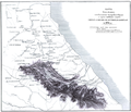
 Часть Карты Дагестана 1841 года.jpg 801 × 597; 252 KB
-
 Lowry, J.W.; Sharpe, J. Russia at the Caucasus. 1847 (J).jpg 936 × 946; 254 KB
-
 Lowry, J.W.; Sharpe, J. Russia at the Caucasus. 1847 (K).jpg 1,139 × 1,113; 353 KB
-
 Карта части Дагестана. Пути следования Аргутинского 1848.png 4,781 × 4,115; 13.15 MB
.jpg)

.jpg)
.jpg)
