Category:1842 maps of Africa
Jump to navigation
Jump to search
Temperate regions: North America · South America · Africa · Europe · Asia · Oceania – Polar regions: – Other regions:
| ← 1840 1841 1842 1843 1844 1845 1846 1847 1848 1849 → |
Media in category "1842 maps of Africa"
The following 15 files are in this category, out of 15 total.
-
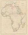
 1842 map of North Western Africa by John Arrowsmith.jpg 14,930 × 11,970; 18.02 MB
-
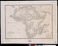
 Africa - DPLA - 994a2787281fb58da0b02d4dacd36fe9.jpg 1,000 × 810; 222 KB
-
 Africa - DPLA - e71085475cc838dfd5133eb8c83836ce.jpg 818 × 1,000; 166 KB
-
 Afrika 1842 Karte.jpg 3,750 × 3,000; 1.47 MB
-
 Cape of Good Hope WDL51.png 1,493 × 1,024; 2.69 MB
-
 Cape of Good Hope. LOC 98687123.jpg 8,752 × 6,000; 7.54 MB
-
 Cape of Good Hope. LOC 98687123.tif 8,752 × 6,000; 150.24 MB
-
 Carte d'Afrique - dressée par A.-H. Dufour - btv1b530886875.jpg 10,879 × 7,662; 11.23 MB
-
-

-
 Carte d'Afrique - par Hérisson ; revue et corrigée par A.-H. Dufour - btv1b53088609r.jpg 10,889 × 7,611; 13.67 MB
-

-
-
-
 Mapa de Africa construido... - por A.-H. Dufour... - btv1b530888048.jpg 11,632 × 8,352; 13.7 MB


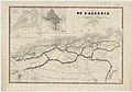
_pour_suivre_les_op%C3%A9rations_militaires_-_dessin%C3%A9_et_grav%C3%A9_par_Ch._Avril_;_lith._A._Bes_et_Dubreuil_fils_a%C3%AEn%C3%A9_-_btv1b530875737.jpg)
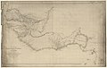
_du_d%C3%A9p%C3%B4t_de_la_Guerre_sur_les_provinces_d%27Alger_d%27Oran_et_Constantine_-_par_A._Vuillemin_-_btv1b530874766.jpg)

