Category:1851 maps of Europe
Jump to navigation
Jump to search
Temperate regions: North America · South America · Africa · Europe · Asia · – Polar regions: – Other regions:
English: 1851 maps of Europe
Español: Mapas de Europa en 1851
Suomi: Euroopan kartat vuodelta 1851
Română: Hărți ale Europei din 1851
Subcategories
This category has the following 8 subcategories, out of 8 total.
.
F
- 1851 maps of France (10 F)
G
S
- 1851 maps of Spain (10 F)
- 1851 maps of Switzerland (8 F)
T
- 1851 maps of Turkey (3 F)
U
Media in category "1851 maps of Europe"
The following 5 files are in this category, out of 5 total.
-
 Carte générale d'Europe dressée - par Charle... - btv1b530930827.jpg 9,400 × 6,752; 10.95 MB
-
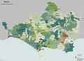 Dorset Map 1851.png 2,163 × 1,586; 811 KB
-
 Plan for Oulu Cemetery 1851.jpg 7,953 × 5,478; 3.19 MB
-

-
 Wydrna Dwor dolny w 1851 r.jpg 445 × 334; 111 KB


