Category:1859 maps of Brest
Jump to navigation
Jump to search
Media in category "1859 maps of Brest"
The following 4 files are in this category, out of 4 total.
-
 9FI 003 10 Détails de la Tour de Brest.jpg 3,916 × 2,616; 4.03 MB
-
 9FI 003 17 Logement du gardien du Fort Montbarey.jpg 3,946 × 2,646; 3.27 MB
-
 Admiralty Chart No 2690 Cap de la Chevre to Pointe de Corsen, Published 1859.jpg 16,385 × 11,269; 65.46 MB
-
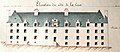 Caserne-plougastel.jpg 750 × 328; 178 KB


