Category:1860s maps of Italy
Jump to navigation
Jump to search
Countries of Europe: Albania · Armenia‡ · Austria · Azerbaijan‡ · Belarus · Belgium · Bosnia and Herzegovina · Bulgaria · Croatia · Cyprus‡ · Czech Republic · Denmark · Estonia · Finland · France‡ · Georgia‡ · Germany · Greece · Hungary · Republic of Ireland · Italy · Latvia · Lithuania · Moldova · Montenegro · Netherlands‡ · Norway · Poland · Portugal‡ · Romania · Russia‡ · Serbia · Slovenia · Spain‡ · Sweden · Switzerland · Turkey‡ · Ukraine · United Kingdom
Limited recognition: Abkhazia‡
‡: partly located in Europe
Limited recognition: Abkhazia‡
‡: partly located in Europe
- Regions of Italy: Liguria ·
Subcategories
This category has the following 11 subcategories, out of 11 total.
- 1860 maps of Italy (2 F)
- 1861 maps of Italy (3 F)
- 1862 maps of Italy (6 F)
- 1866 maps of Italy (5 F)
- 1868 maps of Italy (4 F)
.
Media in category "1860s maps of Italy"
The following 16 files are in this category, out of 16 total.
-

-
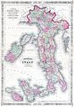 1864 Johnson's Map of Italy - Geographicus - Italy-j-64.jpg 2,085 × 3,000; 1.86 MB
-
 1865 Vallardi bird's eye view of Italy.jpg 6,000 × 4,500; 6.72 MB
-
 Nuova Pianta Degli Scavi di Pompei.jpg 15,832 × 11,662; 23.93 MB
-
 Pianta della citta di Milano, 1865 - btv1b84435492 (1 of 2).jpg 6,660 × 5,266; 6.82 MB
-

-

-
 1865 Spruner Map of Italy under Augustus Caesar - Geographicus - Italia-spruner-1865.jpg 3,500 × 2,766; 2.59 MB
-

-

-

-

-
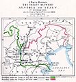 The map of Europe by treaty - Austria Italy 1866.jpg 1,000 × 1,079; 260 KB
-

-
 Das Mittelländische Meer Und Nord-Afrika (Westliches Blatt).jpg 5,771 × 4,795; 11.06 MB
-


.jpg)


%27_(11242327144).jpg)
%27_(11242302785).jpg)
_-_Geographicus_-_MediterraneanSea-admiralty-1868,_Published_1860.jpg)

.jpg)
.jpg)