Category:1875 maps of Africa
Jump to navigation
Jump to search
Temperate regions: North America · South America · Africa · Europe · Asia · Oceania – Polar regions: – Other regions:
| ← 1870 1871 1872 1873 1874 1875 1876 1877 1878 1879 → |
Media in category "1875 maps of Africa"
The following 17 files are in this category, out of 17 total.
-
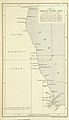
 16 of 'Part II. Second edition' (11109584246).jpg 1,528 × 2,650; 826 KB
-
 17 of 'Part II. Second edition' (11110772326).jpg 1,528 × 2,650; 878 KB
-
 Admiralty Chart No 1808 Africa east coast Cape Delgado to Kilwa, Published1875.jpg 6,208 × 8,220; 5.59 MB
-

-

-
 Aegyptus - DPLA - 2ac448e952e3e422197bec56e4394820.jpg 691 × 1,000; 237 KB
-
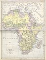
 Africa - DPLA - 1f5faaa484a00bc65dad6dbc98d177ba.jpg 718 × 1,000; 210 KB
-
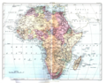
 Africa - DPLA - bc40958d4a80255a470050165447d50f.jpg 776 × 1,000; 286 KB
-
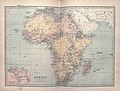 Bartholomew Africa 1875 UTA.jpg 3,669 × 2,784; 2.97 MB
-

-
 EB9 Africa color.png 1,590 × 1,243; 3.66 MB
-

-

-
 Mediterranean map 1875.jpg 13,961 × 6,485; 25.33 MB
-
-

-

.jpg)
.jpg)


,_vom_31_Mai_-_10_Juli_1873_-_DPLA_-_bfa3325d25c011a9d3de4ec56c322f3d.jpg)
