Category:1876 maps of Europe
Jump to navigation
Jump to search
Temperate regions: North America · South America · Africa · Europe · Asia · – Polar regions: – Other regions:
English: 1876 maps of Europe
Español: Mapas de Europa en 1876
Suomi: Euroopan kartat vuodelta 1876
Română: Hărți ale Europei din 1876
Subcategories
This category has the following 15 subcategories, out of 15 total.
.
F
- 1876 maps of France (12 F)
G
- 1876 maps of Georgia (4 F)
I
N
- 1876 maps of Norway (22 F)
R
- 1876 maps of Russia (5 F)
S
- 1876 maps of Spain (4 F)
- 1876 maps of Switzerland (1 F)
T
- 1876 maps of Turkey (2 F)
U
- 1876 maps of Ukraine (1 F)
Media in category "1876 maps of Europe"
The following 9 files are in this category, out of 9 total.
-

-

-
 Europe - par Ch. Larochette... - btv1b53093333r.jpg 13,617 × 10,614; 24.42 MB
-
 FMIB 49367 Track of H M S "Porcupine" -- 1876.jpeg 2,112 × 1,608; 1.08 MB
-

-
 Helsingin kartta Nummelin 1876.png 7,305 × 5,089; 75.39 MB
-
 Karta öfver Uleåborgs stad 1876.jpg 7,490 × 5,937; 5.61 MB
-
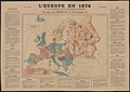 L'Europe en 1876 a la portée des grands esprits.jpg 7,160 × 5,078; 10.43 MB
-
 The Collegiate Atlas 1876 (82450082).jpg 7,921 × 6,660; 6.9 MB
.jpg)
.jpg)


_(14784194882).jpg)


.jpg)