Category:1880s maps of Arabia
Jump to navigation
Jump to search
Media in category "1880s maps of Arabia"
The following 16 files are in this category, out of 16 total.
-
 Image taken from page 507 of 'Histoire universelle' (11146596045).jpg 2,208 × 1,376; 575 KB
-
 Image taken from page 507 of 'Histoire universelle' (16404383289).jpg 797 × 972; 151 KB
-
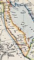 Arabia, Egypt, Nubia and Abyssinia 1883 map (cropped-El Hassa).jpg 757 × 1,324; 1.1 MB
-
 Arabia, Egypt, Nubia and Abyssinia 1883 map.jpg 5,784 × 4,926; 25.74 MB
-
 1885 map of the Arabian Peninsula and Northeast Africa by Adolf Stieler.jpg 10,561 × 8,773; 20.68 MB
-

-
-
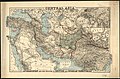 Central Asia - LOC 2013593027.jpg 10,111 × 6,650; 12.05 MB
-
 Central Asia - LOC 2013593027.tif 10,111 × 6,650; 192.37 MB
-
 Stanford's Map of Western Asia (cropped-Hasa).png 948 × 1,278; 2.35 MB
-
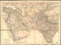
 Stanford's map of western Asia LOC 2013593030.jpg 7,677 × 6,053; 7.86 MB
-
 Stanfords Map of Western Asia.jpg 7,677 × 6,053; 16.02 MB
-
 Pg451.png 2,249 × 1,289; 395 KB
-

-
 Nordost-Afrika und Arabien.jpg 10,714 × 8,878; 21 MB
-
 Image taken from page 507 of 'Histoire universelle' (16404383759).jpg 788 × 975; 122 KB
.jpg)
.jpg)
.jpg)


.png)


.jpg)