Category:1880s maps of China
Jump to navigation
Jump to search
Countries of Asia: Afghanistan · Armenia‡ · Azerbaijan‡ · People's Republic of China · Cyprus‡ · Egypt‡ · Georgia‡ · India · Indonesia‡ · Iran · Iraq · Japan · Jordan · Lebanon · Pakistan · Philippines · Russia‡ · Syria · Turkey‡ · Turkmenistan · Uzbekistan · Yemen
Limited recognition: Abkhazia‡ · Taiwan · State of Palestine
‡: partly located in Asia
Limited recognition: Abkhazia‡ · Taiwan · State of Palestine
‡: partly located in Asia
Subcategories
This category has the following 10 subcategories, out of 10 total.
- 1883 maps of China (3 F)
- 1886 maps of China (12 F)
- 1889 maps of China (1 F)
Media in category "1880s maps of China"
The following 23 files are in this category, out of 23 total.
-

-

-

-

-

-
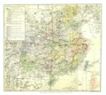
 A Map of China (China's Spiritual Need and Claims, 1887).png 6,324 × 5,633; 52.7 MB
-
 A Map of China (China's Spiritual Need and Claims, 1887).xcf 6,217 × 5,569; 92.34 MB
-
 Guangdong quan sheng shui lu yu tu LOC gm71005159.jpg 14,152 × 11,530; 22.07 MB
-
 Guangdong quan sheng shui lu yu tu LOC gm71005159.tif 14,152 × 11,530; 466.84 MB
-
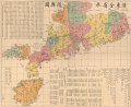
 Huang chao zhi sheng yu di quan tu. LOC gm71005103.jpg 15,408 × 17,612; 39.49 MB
-
 Map of Hong Kong with British Kowloon 1888 24727376.jpg 10,178 × 6,754; 9.22 MB
-
 345 of 'Handbook of Commercial Geography' (11199037383).jpg 2,288 × 1,420; 675 KB
-

-

-

-
 Les côtes de la Chine.jpg 6,889 × 4,735; 4.66 MB
-
 Liaoning 1882 - Shengjing.jpg 7,119 × 5,771; 4.2 MB
-
 Liaoning 1882 Cities - Liaoyang.jpg 6,998 × 5,478; 3.65 MB
-
 Liaoning 1882 Cities - Tieling.jpg 6,936 × 5,740; 4.16 MB
-
 Liaoning 1882 Cities - Xinmintun.jpg 6,599 × 5,403; 3.84 MB
-
 Liaoning 1882 Cities - Yalujiang.jpg 7,009 × 5,769; 3.88 MB
-

-
 Map of Guangdong Province, China, 1889.jpg 3,942 × 2,688; 2.22 MB
.jpg)
.jpg)
._With_map_and_illustrations%27_(11168249585).jpg)
%27_(11166505795).jpg)
.jpg)
.png)


.jpg)
.jpg)
.jpg)
_(14768096042).jpg)


.jpg)
