Category:1880s maps of Greece
Jump to navigation
Jump to search
Countries of Europe: Armenia‡ · Azerbaijan‡ · Belgium · Bosnia and Herzegovina · Bulgaria · Croatia · Cyprus‡ · Czech Republic · Denmark · Estonia · Finland · France‡ · Georgia‡ · Germany · Greece · Hungary · Iceland · Republic of Ireland · Italy · Latvia · Lithuania · Montenegro · Netherlands‡ · Norway · Poland · Portugal‡ · Romania · Russia‡ · Serbia · Slovakia · Slovenia · Spain‡ · Sweden · Switzerland · Turkey‡ · Ukraine · United Kingdom
Limited recognition: Abkhazia‡
‡: partly located in Europe
Limited recognition: Abkhazia‡
‡: partly located in Europe
Media in category "1880s maps of Greece"
The following 13 files are in this category, out of 13 total.
-

-
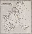 1542 SyraHarbour.jpg 1,379 × 1,468; 201 KB
-

-
 IAN 0130 Mansell 1880 Preveza.jpg 3,876 × 5,760; 8.08 MB
-
 Jouvet et Cie. Grece. Caucase et Crimee. 1882.jpg 3,859 × 5,268; 3.8 MB
-

-
-

-

-

-
 30 of 'Rambles and Studies in Greece. Third edition ... enlarged' (11189251975).jpg 1,936 × 1,252; 550 KB
-
 560 of 'Cassell's Illustrated Universal History' (11156078363).jpg 1,918 × 2,120; 1.04 MB
-
 Χαρτης Κεντρικής Μακεδονίας 1887.jpg 1,024 × 730; 329 KB
%27_(11180770295).jpg)

_With_numerous_maps_and_notes%27_(11108913983).jpg)


%27_(11166010765).jpg)
%27_(11167615694).jpg)
.jpg)
%27_(11185292984).jpg)
%27_(11185216746).jpg)
.jpg)
.jpg)
