Category:1881 maps of Iowa
Jump to navigation
Jump to search
States of the United States: California · Connecticut · Hawaii · Idaho · Illinois · Iowa · Louisiana · Maryland · Massachusetts · Michigan · New Mexico · New York · Pennsylvania · South Dakota · Texas · Utah · Wyoming
| 1881 1883 1884 1885 1886 1887 1888 1889 → |
Media in category "1881 maps of Iowa"
The following 15 files are in this category, out of 15 total.
-
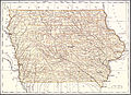 EB9 Iowa.jpg 3,690 × 2,676; 2.11 MB
-
 Map of Linn County, Iowa (NYPL b11655881-5366938).tiff 10,328 × 7,760; 229.53 MB
-
 Map of Linn County, Iowa (NYPL b11655881-5366939).tiff 10,314 × 7,749; 228.89 MB
-
 Map of Linn County, Iowa (NYPL b11655881-5366940).tiff 10,196 × 11,587; 338.24 MB
-
 Map of Linn County, Iowa (NYPL b11655881-5366941).tiff 10,328 × 7,760; 229.53 MB
-
 Map of Linn County, Iowa (NYPL b11655881-5366942).tiff 10,328 × 7,760; 229.53 MB
-
 Map of Linn County, Iowa (NYPL b11655881-5366943).tiff 10,061 × 11,637; 335.2 MB
-
 Map of Linn County, Iowa (NYPL b11655881-5366944).tiff 10,328 × 7,760; 229.53 MB
-
 Map of Linn County, Iowa (NYPL b11655881-5366945).tiff 10,328 × 7,760; 229.53 MB
-
 Map of Linn County, Iowa (NYPL b11655881-5366946).tiff 10,038 × 10,951; 314.73 MB
-
 Map of Linn County, Iowa (NYPL b11655881-5366947).tiff 10,328 × 7,760; 229.53 MB
-
 Map of Linn County, Iowa (NYPL b11655881-5366948).tiff 10,328 × 7,760; 229.53 MB
-
 Map of Linn County, Iowa (NYPL b11655881-5366949).tiff 10,104 × 11,588; 335.21 MB
-
 Railroad map of Iowa. LOC 98688480.jpg 10,720 × 7,184; 17.71 MB
-
 Railroad map of Iowa. LOC 98688480.tif 10,720 × 7,184; 220.33 MB

