Category:1889 maps of Michigan
Jump to navigation
Jump to search
States of the United States: California · Connecticut · Florida · Georgia · Illinois · Indiana · Iowa · Kansas · Kentucky · Louisiana · Maine · Massachusetts · Michigan · Minnesota · Mississippi · Missouri · Montana · New Hampshire · New Jersey · New Mexico · New York · Ohio · Oregon · Pennsylvania · Rhode Island · South Carolina · Tennessee · Texas · Utah · Vermont · Washington · Wisconsin
| ← 1880 1881 1883 1884 1885 1886 1887 1888 1889 → |
Subcategories
This category has the following 6 subcategories, out of 6 total.
A
D
Media in category "1889 maps of Michigan"
The following 7 files are in this category, out of 7 total.
-
 Benton Harbor 1889.jpg 1,024 × 787; 638 KB
-
 Benton Harbor, Mich. 1889. LOC 75694615.jpg 9,056 × 7,307; 17.1 MB
-
 Birds-eye view of Muskegon, Michigan 1889, from Muskegon Lake looking east. LOC 75694630.jpg 12,768 × 8,544; 24.17 MB
-

-
 Sanborn Fire Insurance Map from Detroit, Wayne County, Michigan. LOC sanborn03985 003-3.tif 5,788 × 7,795; 129.08 MB
-

-
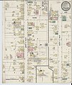 Sanborn Fire Insurance Map from Zeeland, Ottawa County, Michigan. LOC sanborn04241 001.jpg 6,510 × 7,707; 4.24 MB


