Category:1890s maps of Utah
Jump to navigation
Jump to search
States of the United States: Alabama · Alaska · Arizona · Arkansas · California · Colorado · Connecticut · Delaware · Florida · Georgia · Hawaii · Idaho · Illinois · Indiana · Iowa · Kansas · Kentucky · Louisiana · Maine · Maryland · Massachusetts · Michigan · Minnesota · Mississippi · Missouri · Montana · Nebraska · Nevada · New Hampshire · New Jersey · New Mexico · New York · North Carolina · North Dakota · Ohio · Oklahoma · Oregon · Pennsylvania · Rhode Island · South Carolina · South Dakota · Tennessee · Texas · Utah · Vermont · Virginia · Washington · West Virginia · Wisconsin · Wyoming – Washington, D.C.
Puerto Rico
Puerto Rico
Subcategories
This category has the following 5 subcategories, out of 5 total.
- 1891 maps of Utah (4 F)
- 1893 maps of Utah (1 F)
- 1894 maps of Utah (2 F)
- 1895 maps of Utah (4 F)
Media in category "1890s maps of Utah"
The following 8 files are in this category, out of 8 total.
-
 US-MAPS(1891) p503 - MAP OF UTAH.jpg 1,504 × 2,160; 1.13 MB
-

-
 332 of 'Elementary Physical Geography' (11299155524).jpg 1,410 × 1,446; 410 KB
-

-
 567 of 'History of Utah ... 1540-1887. (With a bibliography.)' (11296098543).jpg 1,390 × 828; 230 KB
-
 Map from Indian land cessions in the United States by Charles C. Royce 62.jpg 3,297 × 4,256; 3.95 MB
-
 Map of Utah and Colorado.jpg 3,465 × 2,938; 3.28 MB
-
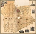 Salt Lake County.jpg 4,456 × 4,189; 3.71 MB
_p503_-_MAP_OF_UTAH.jpg)

.jpg)
%27_(11115397114).jpg)
%27_(11296098543).jpg)


