Category:1893 maps of India
Jump to navigation
Jump to search
English: 1893 maps made in India or from India or showing history of India
Subcategories
This category has only the following subcategory.
M
- Maps from Constable Hand Atlas (19 F)
Media in category "1893 maps of India"
The following 28 files are in this category, out of 28 total.
-
 171 of 'Leerboek der Aardsrijkskunde. Met Schetskaartjes, etc' (11223586566).jpg 1,375 × 1,893; 448 KB
-

-
 Bengal map 1893.JPG 1,063 × 1,327; 396 KB
-
 Bombay City map (1893).jpg 1,271 × 1,751; 381 KB
-
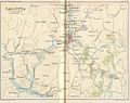 CalcuttaEnvirons1893.jpg 1,273 × 1,009; 220 KB
-
 Constable's hand atlas of India.djvu 1,275 × 1,650, 470 pages; 6.16 MB
-
 India in 1893, geological features.jpg 2,340 × 2,958; 6.06 MB
-
 India, distribution of languages, 1893.jpg 955 × 1,285; 216 KB
-
 Indian Railway network 1893.jpg 985 × 1,273; 242 KB
-
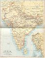
 IndiaPolitical1893ConstablesHandAtlas.jpg 1,318 × 1,027; 341 KB
-
 Island of Bombay Map 1812-16.jpg 3,304 × 5,009; 2.87 MB
-
 IslandsofBombay1893.jpg 521 × 800; 102 KB
-
 Map of Bombay from maps of constable' 1893 hand atlas.jpg 1,271 × 1,751; 444 KB
-
 Map of Calcutta from maps of Constable's 1893 Hand Atlas.jpg 1,296 × 1,726; 548 KB
-
 Map of Delhi from mpas of Constable's 1893 Hand Atls.jpg 979 × 1,303; 208 KB
-
 Map of Luknow from maps of constable' 1893 hand atlas.jpg 1,231 × 955; 216 KB
-
 Map of Madras from Maps of constable 1893 Hand Atlas.jpg 1,316 × 1,756; 506 KB
-

-
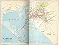 Mapkhi1893.jpg 1,273 × 973; 155 KB
-
 MAPS FROM CONSTABLE'S 1893 HAND ATLAS - 2.jpeg 1,021 × 1,339; 1.06 MB
-
 MAPS FROM CONSTABLE'S 1893 HAND ATLAS - 26.jpeg 200 × 267; 28 KB
-
 MAPS FROM CONSTABLE'S 1893 HAND ATLAS - 31.jpeg 200 × 159; 22 KB
-
 MAPS FROM CONSTABLE'S 1893 HAND ATLAS - 4.jpeg 1,336 × 1,751; 988 KB
-
 Plate 32. Sect. XI- Central Provinces maps from Constable 1893 Hand Atlas.jpg 1,766 × 1,440; 808 KB
-
 Plate 34. Sect. XIII- Madras, Mysore and Goa maps from Constable 1893 Hand Atlas.jpg 1,736 × 1,376; 830 KB
-

-
 The distribution of forest trees in India, 1893.jpg 8,999 × 7,687; 8.12 MB
-

.jpg)
%27_(11222309153).jpg)

.jpg)


.jpg)


