Category:1895 maps of Texas
Jump to navigation
Jump to search
States of the United States: California · Connecticut · Florida · Georgia · Illinois · Iowa · Kentucky · Louisiana · Maine · Maryland · Massachusetts · Michigan · Minnesota · Mississippi · Missouri · Nevada · New Jersey · New York · Ohio · Oklahoma · Oregon · Pennsylvania · Rhode Island · South Carolina · Tennessee · Texas · Utah · Vermont · Virginia · Washington · West Virginia · Wisconsin · Wyoming – Washington, D.C.
| ← 1890 1891 1892 1893 1894 1895 1896 1897 1898 1899 → |
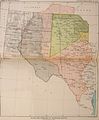
Media in category "1895 maps of Texas"
The following 14 files are in this category, out of 14 total.
-

-
-
 City of Houston and environs LOC 2007630436.jpg 9,685 × 8,756; 13.71 MB
-
 City of Houston and environs LOC 2007630436.tif 9,685 × 8,756; 242.62 MB
-
 Map of Anderson County. LOC 2012586617.jpg 11,301 × 13,797; 18.22 MB
-
 Map of Anderson County. LOC 2012586617.tif 11,301 × 13,797; 446.09 MB
-
 Map of Liberty County, Texas - General Land Office LOC 2010585337.jpg 10,816 × 10,138; 11.19 MB
-
 Map of Liberty County, Texas - General Land Office LOC 2010585337.tif 10,816 × 10,138; 313.72 MB
-
 Map of Orange County. LOC 2012590095.jpg 11,178 × 10,803; 11.35 MB
-
 Map of Orange County. LOC 2012590095.tif 11,178 × 10,803; 345.49 MB
-
 Map of Wise County LOC 2012592136.jpg 10,791 × 12,274; 24.25 MB
-
 Map of Wise County LOC 2012592136.tif 10,791 × 12,274; 378.94 MB
-
 Rusk Co., Texas LOC 2012590081.jpg 9,865 × 13,560; 14.74 MB
-
 Rusk Co., Texas LOC 2012590081.tif 9,865 × 13,560; 382.72 MB
_(19174604210).jpg)
_(19176082759).jpg)


