Category:18th-century maps of Aube
Jump to navigation
Jump to search
Media in category "18th-century maps of Aube"
The following 2 files are in this category, out of 2 total.
-
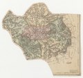 Carte du département de l'Aube - 1790-1793.tif 5,712 × 5,319; 86.97 MB
-
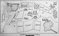 Chapelle st victor Renfroissart par Ch Favet 09188.jpg 2,637 × 1,644; 1.82 MB
