Category:18th-century maps of Montenegro
Jump to navigation
Jump to search
Countries of Europe: Albania · Armenia‡ · Austria · Azerbaijan‡ · Belarus · Belgium · Bosnia and Herzegovina · Bulgaria · Croatia · Cyprus‡ · Czech Republic · Denmark · Estonia · Finland · France‡ · Georgia‡ · Germany · Greece · Hungary · Iceland · Republic of Ireland · Italy · Latvia · Lithuania · Luxembourg · Malta · Moldova · Montenegro · Netherlands‡ · Norway · Poland · Portugal‡ · Romania · Russia‡ · Serbia · Slovakia · Slovenia · Spain‡ · Sweden · Switzerland · Turkey‡ · Ukraine · United Kingdom
Specific status: Isle of Man – Limited recognition: Abkhazia‡
‡: partly located in Europe
Specific status: Isle of Man – Limited recognition: Abkhazia‡
‡: partly located in Europe
Subcategories
This category has the following 3 subcategories, out of 3 total.
- 1720s maps of Montenegro (empty)
- 1760s maps of Montenegro (empty)
- 1770s maps of Montenegro (empty)
Media in category "18th-century maps of Montenegro"
The following 3 files are in this category, out of 3 total.
-
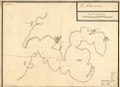
 Plano del Golfo de Catarro. LOC 90683810.jpg 4,505 × 3,274; 1.24 MB
-
 Plano del Golfo de Catarro. LOC 90683810.tif 4,505 × 3,274; 42.2 MB
-

