Category:18th-century maps of the Malay Archipelago
Jump to navigation
Jump to search

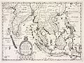
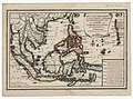
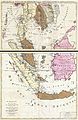
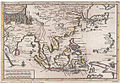
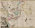
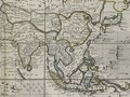
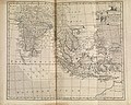
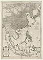
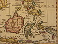
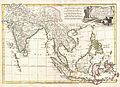
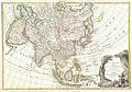
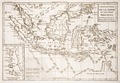
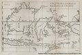
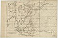
English: Note: The Malay Archipelago may also be called East Indies or East Indian Archipelago or a similar name on maps of the era of European exploration and colonization. It comprises of the islands marked green in the map of the right side. Please only include maps here that show the whole or most of the archipelago. Maps focusing on specific islands or focusing or certain countries, should go in the corresponding category of that island or country.
Subcategories
This category has the following 11 subcategories, out of 11 total.
1
B
- 18th-century maps of Borneo (15 F)
I
J
M
N
- 18th-century maps of New Guinea (10 F)
P
S
- 18th-century maps of Sulawesi (32 F)
- 18th-century maps of Sumatra (37 F)
Media in category "18th-century maps of the Malay Archipelago"
The following 60 files are in this category, out of 60 total.
-
-

-
 B26055990C - Nova tabvla India Orientalis.jpg 6,244 × 4,934; 8.22 MB
-

-
-
 B26056051C - Insvla Indica cvm terris circvmvicinis.jpg 6,670 × 4,425; 7.22 MB
-
 1705 map - Carte des Indes et de la Chine.jpg 16,281 × 15,523; 49.69 MB
-
 AMH-6667-KB Map of the Moluccas.jpg 2,400 × 1,914; 1,004 KB
-
 1706 de la Feuille Map of Asia - Geographicus - Asia-lafeuille-1706.jpg 2,268 × 1,669; 728 KB
-

-
-
 B26056113B - India orientalis.jpg 3,866 × 3,091; 3.06 MB
-
 Pieter van der Aa South-East-Asia 1713.jpg 568 × 392; 249 KB
-
 B26055982D - Orientaliora Indiarum Orientalium cum insulis adjacentibus.jpg 5,642 × 4,618; 7.14 MB
-
 AMH-5521-NA Map of Sumatra to the Moluccas.jpg 2,400 × 2,034; 728 KB
-
-
 B26055931I - Carte des Indes, de la Chine des Iles de Sumatra, Java.jpg 5,860 × 6,124; 11.21 MB
-
 The Philippine islands and others of the East Indies according to newest descriptions.png 3,357 × 2,340; 11.73 MB
-
 AMH-7120-KB Map of Asia and Australia.jpg 2,400 × 2,092; 1.37 MB
-

-

-
 South Asia, 1744.jpg 6,453 × 5,161; 7.02 MB
-
 A map of Java, Borneo and the islands to the eastward of them as far as Nova Guinea.jpg 8,526 × 5,763; 2.53 MB
-
 AMH-7928-KB Map of Sumatra, Java, Borneo and Malaysia.jpg 2,400 × 2,048; 1.05 MB
-
 AMH-7929-KB Map of Celebes, the Moluccas and the Philippines.jpg 1,763 × 2,400; 790 KB
-
 B26056152E - Isles Philippines et Moluques.jpg 3,757 × 4,925; 4.48 MB
-

-

-

-

-

-
-
 Southsoutheast1752se.jpg 800 × 600; 133 KB
-
 Seconde partie de la carte d'Asie.tif 9,783 × 6,768; 189.43 MB
-

-

-
 Philippinescelebes.jpg 552 × 792; 106 KB
-
-

-
 1770 Janvier Map of Asia - Geographicus - Asia-janvier-1770.jpg 4,000 × 2,800; 3.24 MB
-

-

-
 Rigobert-Bonne-Atlas-de-toutes-les-parties-connues-du-globe-terrestre MG 9995.tif 5,250 × 3,630; 54.56 MB
-
 1781 Batavia map detail byJohnLodge BostonPublicLibrary 14664.png 1,062 × 746; 1.42 MB
-

-
 1791 map by Moore, crop on Southeast Asia.jpg 4,018 × 3,669; 3.08 MB
-
 A new chart of the China, with its several entrances.jpg 7,728 × 11,402; 11.95 MB
-

-

-
 L'Indie (Antonio Zatta 1794, twelve small maps).jpg 532 × 367; 77 KB
-

-
 Map China c1798.jpg 940 × 894; 297 KB
-
 Asia1799.jpg 16,229 × 7,031; 44.52 MB
-

-

-
-

-
 A map of Java, Borneo and the islands to the eastward of them as far as Nova Guinea.pdf 2,131 × 1,439; 2.36 MB
-
-
 Forrest 1779 Chart Track of Tartar Galley voyagetonewguine00forr 0033.jpg 3,921 × 2,543; 1.39 MB
.jpg)

_(14580899828).jpg)


,_Malaysia,_Sumatra,_Borneo_-_Geographicus_-_Siam-ottens-1710.jpg)


.jpg)
,_NG-501-74.jpg)


,_1766_asia_(1752)_south_east.jpg)
.jpg)
.jpg)


.jpg)
.jpg)

_-_Geographicus_-_SoutheastAsia-bonne-1770.jpg)
_-_Geographicus_-_EastIndies-bonne-1780.jpg)

%27_(11224794306).jpg)
_-_Geographicus_-_Moluques-bonne-1780.jpg)

.jpg)


.jpg)

.jpg)


.jpg)
.jpg)


