Category:18th-century maps of the North Sea
Jump to navigation
Jump to search
Media in category "18th-century maps of the North Sea"
The following 26 files are in this category, out of 26 total.
-
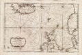
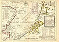 Part of ye Sea Coast of England Holland & Flanders Atlas Minor 1736.jpg 3,284 × 2,390; 1.4 MB
-

-

-
 A Chart of the North Sea - btv1b5973360t (1 of 2).jpg 10,768 × 7,760; 9.83 MB
-
 A Chart of the North Sea - btv1b5973360t (2 of 2).jpg 10,704 × 7,760; 10.87 MB
-

-
 A chart of EEMS ELVE, Wefer, Eyder and Hever. With the Holy Island NYPL1640697.tiff 7,230 × 5,428; 112.28 MB
-
 A chart of JUTLAND and the Islands of Omtren NYPL1640696.tiff 7,230 × 5,428; 112.28 MB
-
 A chart of the North Sea - btv1b5973390z.jpg 9,659 × 16,189; 23.78 MB
-
 A chart of the North Sea from the Forelands to North Bergen - btv1b5973371m.jpg 12,845 × 11,198; 20.71 MB
-
 A chart of the North Sea from the Forelands to North Bergen - btv1b5973373f.jpg 12,294 × 10,929; 19.08 MB
-
-
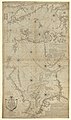
 A chart of the NORTH SEA NYPL1640558.tiff 7,230 × 5,428; 112.28 MB
-
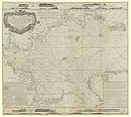
 A Chart of the North Sea... - btv1b5973349s.jpg 7,584 × 6,104; 7.49 MB
-
 A chart of the Sea-Coast of ZEALAND from Walcheren to the Macs NYPL1640701.tiff 7,230 × 5,428; 112.28 MB
-

-
 A chart of the SOUTH SEA Texel and Flieftream with Amelander gat NYPL1640699.tiff 7,230 × 5,428; 112.28 MB
-
 A general chart of the Northern navigation from England to Russia - btv1b5970635v.jpg 12,236 × 10,999; 17.62 MB
-
 Atlas - no-nb krt 00763.jpg 9,797 × 8,024; 24.65 MB
-

-
 Carte reduite de la mer du nord Zusammengezogene Karte des Nordmeeres Bellin 1772.jpg 4,449 × 2,670; 1.48 MB
-
 La Mer du Nord.jpg 9,018 × 6,670; 11.94 MB
-
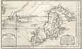
 A chart of the NORTH SEA (NYPL b13909432-1640558).jpg 5,931 × 4,880; 7.99 MB
-
 Sjøkart over Nordsjøen og Kattegat, fra 1796.png 3,262 × 3,830; 25.79 MB
-
 Sjøkart over Nordsjøen, fra ukjent årstall.png 4,535 × 2,738; 26.74 MB
-
 Sjøkart over Nordsjøen, mellom Skottland, Dannmark, Norge og Island, fra 1768.png 4,289 × 2,901; 27.08 MB


.jpg)
.jpg)
.jpg)


.jpg)


