Category:18th century maps of Doubs (department)
Jump to navigation
Jump to search
Media in category "18th century maps of Doubs (department)"
The following 14 files are in this category, out of 14 total.
-
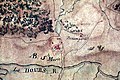 Abbaye de Mont-Sainte-Marie - img 48193.jpg 5,616 × 3,744; 9.62 MB
-
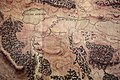
 Chantegrue - img 48196.jpg 5,616 × 3,744; 9.67 MB
-
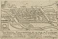 Description topographique de la ville de Pontarlier par Claude Bonjour vers 1700.jpg 4,553 × 3,130; 3.52 MB
-
 Jougne - img 48208.jpg 5,616 × 3,744; 8 MB
-
 Labergement - img 48175.jpg 5,616 × 3,744; 8.88 MB
-
 Le Brey - img 48177.jpg 5,346 × 3,663; 8.4 MB
-
 Metabief - img 48206.jpg 5,616 × 3,744; 8.74 MB
-
 Mouthe - img 48222.jpg 3,744 × 5,616; 8.82 MB
-
 Petite Chaux - img 48226.jpg 5,340 × 3,305; 7.85 MB
-
 Plan 1702.JPG 1,118 × 784; 1.07 MB
-
 Remoray - img 48181.jpg 5,352 × 3,257; 7.63 MB
-
 Rochejean - img 48183.jpg 5,616 × 3,744; 7.75 MB
-
 Sarrageois - img 48223.jpg 5,616 × 3,744; 9.19 MB
-
 Vaux - img 48195.jpg 5,616 × 3,744; 9.87 MB


