Category:1900 maps of Canada
Jump to navigation
Jump to search
Countries of North America: Belize · Canada · United States of America‡
‡: partly located in North America
‡: partly located in North America
| ← 1900 1901 1902 1903 1904 1905 1906 1907 1908 1909 → |
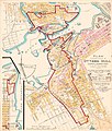
English: Maps of Canada from 1900 or related to Canada in 1900
Français : Les cartes du Canada de 1900 ou se rapportant au Canada en 1900
Subcategories
This category has the following 2 subcategories, out of 2 total.
O
Q
- 1900 maps of Quebec (4 F)
Media in category "1900 maps of Canada"
The following 5 files are in this category, out of 5 total.
-

-
 Plan showing extent of Ottawa-Hull Conflagration.jpg 2,400 × 2,826; 2.4 MB
-
 Plan showing extent of Ottawa-Hull fire 1900.jpg 1,687 × 2,075; 924 KB
-

-

_(14761847941).jpg)


_(14565814508).jpg)
_(20781281521).jpg)