Category:1900s maps of France
Jump to navigation
Jump to search
Countries of Europe: Albania · Armenia‡ · Azerbaijan‡ · Belarus · Belgium · Bosnia and Herzegovina · Bulgaria · Croatia · Cyprus‡ · Czech Republic · Denmark · Finland · France‡ · Georgia‡ · Germany · Greece · Hungary · Iceland · Republic of Ireland · Italy · Lithuania · Netherlands‡ · Norway · Poland · Portugal‡ · Romania · Russia‡ · Serbia · Slovakia · Spain‡ · Sweden · Switzerland · Turkey‡ · Ukraine · United Kingdom
Limited recognition: Abkhazia‡
‡: partly located in Europe
Limited recognition: Abkhazia‡
‡: partly located in Europe
Subcategories
This category has the following 11 subcategories, out of 11 total.
- 1903 maps of France (3 F)
T
- Tour de France maps of the 1900s (11 F)
Media in category "1900s maps of France"
The following 17 files are in this category, out of 17 total.
-

-

-
 Anjouan Map 1930.jpg 1,942 × 1,208; 1.32 MB
-
 Bouguignons.PNG 516 × 744; 873 KB
-

-
 Chandernaggar-Calcuta Map 1900.jpg 1,031 × 2,052; 744 KB
-

-
 GrandeComore Map 1930.jpg 1,192 × 1,900; 1.37 MB
-
 Karikal FrIndia Map 1900.jpg 1,288 × 1,147; 605 KB
-
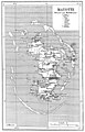
 Mahe FrIndia Map 1900.jpg 910 × 877; 377 KB
-
 Mayotte Map 1930.jpg 1,250 × 1,956; 1.4 MB
-

-
-
 Pondicherry Map 1900.jpg 1,645 × 1,937; 1.4 MB
-

-

-
 Yanaon Map 1900.jpg 1,424 × 1,428; 877 KB

_(14577683039).jpg)


,_Touraine,_Orl%C3%A9anais,_Maine._Paris,_Granville,_Rennes,_Nantes,_Tours,_Chinon,_Vierzon,_dress%C3%A9e_par_J._Forest..._-_btv1b53029771x.jpg)

._P._Bineteau_del._Reymond_se._-_btv1b53197282n.jpg)


.jpg)


_-_Plan_du_quai_pr%C3%A9vu_pour_recevoir_une_voie_Decauville.jpg)

