Category:1900s maps of Iran
Jump to navigation
Jump to search
Countries of Asia: Afghanistan · Armenia‡ · Azerbaijan‡ · People's Republic of China · Cyprus‡ · Egypt‡ · Georgia‡ · India · Indonesia‡ · Iran · Iraq · Japan · Jordan · Lebanon · Pakistan · Philippines · Russia‡ · Syria · Thailand · Turkey‡ · Uzbekistan
Limited recognition: Abkhazia‡ · Taiwan · State of Palestine
‡: partly located in Asia
Limited recognition: Abkhazia‡ · Taiwan · State of Palestine
‡: partly located in Asia
Subcategories
This category has the following 4 subcategories, out of 4 total.
- 1900 maps of Iran (3 F)
- 1905 maps of Iran (15 F)
- 1908 maps of Iran (3 F)
Media in category "1900s maps of Iran"
The following 9 files are in this category, out of 9 total.
-

-
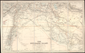
 The Euphrates Valley - Syria, Kurdistan, etc. LOC 2013593032.jpg 8,752 × 5,468; 7.43 MB
-
 The Euphrates Valley - Syria, Kurdistan, etc. LOC 2013593032.tif 8,752 × 5,468; 136.92 MB
-
 Stanford, Edward. Asia Minor, Caucasus, Black Sea. 1901 (W).jpg 962 × 984; 380 KB
-
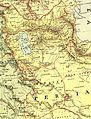 Stanford, Edward. Asia Minor, Caucasus, Black Sea. 1901 (Z).jpg 1,149 × 1,505; 599 KB
-

-
 The Harmsworth atlas and Gazetter 1908 (135850193).jpg 12,545 × 9,572; 133.13 MB
-
 Ca. 1909 Ottoman map of the Ottoman Iraq - Iran border by the Special Border Commission.jpg 30,000 × 10,054; 30.06 MB
-
 The Euphrates Valley - Syria, Kurdistan, et cetera by Edward Stanford Ltd. - WDL.png 1,638 × 1,024; 3.03 MB
_(14764348212).jpg)

.jpg)
.jpg)
_(14769238742).jpg)
.jpg)
