Category:1909 maps of Washington, D.C.
Jump to navigation
Jump to search
States of the United States: California · Georgia · Hawaii · Idaho · Illinois · Iowa · Kansas · Kentucky · Louisiana · Massachusetts · Michigan · Minnesota · Missouri · Nevada · New Jersey · New York · North Dakota · Ohio · Pennsylvania · South Dakota · Texas · Utah · Vermont · Washington · Wisconsin – Washington, D.C.
| ← 1900 1901 1902 1903 1904 1905 1907 1909 → |
Media in category "1909 maps of Washington, D.C."
The following 6 files are in this category, out of 6 total.
-
 1909 map of Washington, DC.jpg 5,636 × 6,265; 27.18 MB
-
 Automobile map of Washington district. LOC 87695631.jpg 12,515 × 8,536; 19.98 MB
-

-
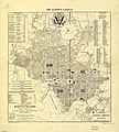 The nation's capital - (Washington D.C.) LOC 87691457.jpg 5,636 × 6,265; 4.68 MB
-
 Washington, D.C. LOC 87691456.jpg 8,211 × 6,307; 9.52 MB
-
 Washington, District of Columbia LOC 87691455.jpg 4,978 × 2,537; 2.48 MB


_LOC_87691457.jpg)

