Category:1910s maps of Arabia
Jump to navigation
Jump to search
Media in category "1910s maps of Arabia"
The following 31 files are in this category, out of 31 total.
-

-

-
-

-
 Политическая карта Азии начало XX века.jpg 3,194 × 2,128; 1.54 MB
-
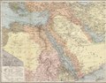
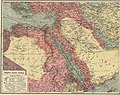
 Brockhaus and Efron Jewish Encyclopedia e3 029-0.jpg 1,051 × 948; 434 KB
-
 1914 map - Flemmings Karte für das türkische Interessen-Gebiet - Arabia cropped.tif 4,824 × 3,760; 52.53 MB
-
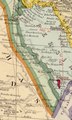
 1914 map of Asia (cropped-El Haza).jpg 221 × 278; 20 KB
-
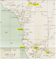
 Anglo-Turkish Boundary Commission map of Cape Bab el-Mandeb.jpg 1,731 × 2,905; 2.93 MB
-
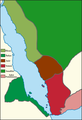
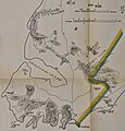 Cape Bab el-Mandeb Anglo-Turkish Demarcation Line.jpg 1,385 × 1,441; 435 KB
-
-
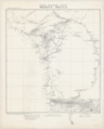
 1916 map by the British Admiralty War Staff - ARABIA - Districts and Towns.jpg 11,060 × 8,873; 10.88 MB
-
 1916 map by the British Admiralty War Staff - ARABIA - Land Surface Features.jpg 11,015 × 8,900; 12 MB
-
 1916 map by the British Admiralty War Staff - ARABIA - Orographical Features.jpg 11,043 × 9,072; 13.17 MB
-
 1916 map by the British Admiralty War Staff - Tribal map of ARABIA.jpg 7,163 × 7,170; 5.92 MB
-
 HejOut.svg 574 × 602; 115 KB
-
-

-
 Democratic Ideals and Reality, 1919 Fig 19 p 112.jpg 1,319 × 1,056; 157 KB
-
 1919 Red Sea.png 693 × 1,017; 130 KB
-
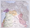
 Hejaz, Asir, Yemen (1919).jpg 693 × 1,017; 238 KB
-
 Ottoman Empire - Medina-Mecca sheet.png 10,680 × 13,270; 84.32 MB
-
 S.W. Arabia, Sheet 1, Taiz.png 9,453 × 7,098; 104.28 MB
-
 S.W. Arabia, Sheet 2, Sanaa.png 9,916 × 6,767; 98.62 MB
-
 S.W. Arabia, Sheet 3, Saada.png 9,791 × 6,854; 93.98 MB
-
 S.W. Arabia, Sheet 4, Ebha.png 8,665 × 7,744; 83.34 MB
-
 S.W. Arabia, Sheet 5, Wadi Shehran.png 9,040 × 7,423; 85.97 MB
-
 S.W. Arabia, Sheet 6, Kunfuda.png 9,177 × 7,312; 95.48 MB
-
 S.W. Arabia, Sheet 7, Wadi Bishe.png 8,701 × 7,712; 88.9 MB
-
 S.W. Arabia, Sheet 8, Mecca.png 7,703 × 8,711; 84.11 MB
-
 S.W. Arabia, Sheet 9, Taif.png 9,437 × 7,111; 95.8 MB


.jpg)


.jpg)


.jpg)


