Category:1912 maps of the United States
Jump to navigation
Jump to search
Countries of the Americas: Belize · Brazil · Canada · Mexico · United States of America
Other areas: Dutch Caribbean
Other areas: Dutch Caribbean
Other areas: Hawaii
States of the United States: California · Delaware · Georgia · Hawaii · Idaho · Illinois · Iowa · Kansas · Louisiana · Massachusetts · Michigan · Minnesota · Missouri · Nevada · New Mexico · New York · Ohio · Pennsylvania · South Dakota · Texas · Vermont · Virginia · Wisconsin · Wyoming
Subcategories
This category has the following 25 subcategories, out of 25 total.
C
D
G
H
I
K
- 1912 maps of Kansas (1 F)
L
M
N
- 1912 maps of New Mexico (empty)
O
P
S
T
- 1912 maps of Texas (14 F)
V
- 1912 maps of Virginia (2 F)
W
Media in category "1912 maps of the United States"
The following 14 files are in this category, out of 14 total.
-

-
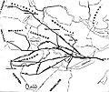 1912 map of surface lines connecting to the Cambridge Subway.jpg 5,273 × 4,438; 1.07 MB
-
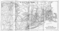 1912 New Haven Railroad system map.png 4,367 × 2,290; 10.33 MB
-

-
 Blank 1912 county map.svg 1,400 × 980; 1.33 MB
-

-
-

-
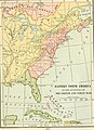
 History and government of the United States, for evening schools (1912) (14777695552).jpg 3,264 × 2,064; 1.03 MB
-
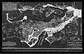 Map of Seattle, ca 1912 (MOHAI 1845).jpg 640 × 415; 74 KB
-

-
 Presidential map LCCN2011645484.jpg 6,384 × 5,124; 2.96 MB
-

-
 William H. Walker United States of Guggenheimerica 1912 Cornell CUL PJM 1170 01.jpg 7,853 × 4,958; 6.67 MB


_(14774844161).jpg)
_(14774857931).jpg)
_(14774863781).jpg)
_(14777695552).jpg)
.jpg)


